Area Overview for GU15 3BB
Photos of GU15 3BB
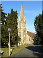
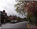
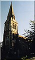
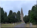
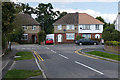
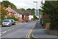
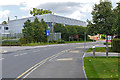
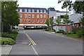
42 photos from this area
Area Information
Key information about the GU15 3BB including its size, population, and administrative classification.
- Area Type
- Postcode
- Area Size
- 1.2 hectares
- Population
- 2162
- Population Density
- 1808 people/km²
House Prices in GU15 3BB
41
Properties
£277,882
Average Sold Price
£79,000
Lowest Price
£560,000
Highest Price
Showing 41 properties
| Address | Type | Beds | Baths | Last Sale Price | Last Sale Date | |
|---|---|---|---|---|---|---|
| 17 Edward Avenue, Camberley, GU15 3BB | Semi-detached | 3 | - | £380,000 | May 2024 | |
| 37 Edward Avenue, Camberley, GU15 3BB | Terraced | 2 | 1 | £312,000 | Oct 2023 | |
| 15 Edward Avenue, Camberley, GU15 3BB | Detached | 4 | 2 | £560,000 | May 2023 | |
| 10 Edward Avenue, Camberley, GU15 3BB | Semi-detached | 3 | 1 | £360,000 | Sep 2020 | |
| 33 Edward Avenue, Camberley, GU15 3BB | Terraced | 2 | 1 | £290,000 | Sep 2019 | |
| 5 Edward Avenue, Camberley, GU15 3BB | Semi-detached | 3 | 1 | £360,000 | Aug 2019 | |
| 7 Edward Avenue, Camberley, GU15 3BB | Semi-detached | 3 | 1 | £335,000 | Jun 2019 | |
| 8 Edward Avenue, Camberley, GU15 3BB | Semi-detached | 3 | 1 | £365,000 | Mar 2019 | |
| 12 Edward Avenue, Camberley, GU15 3BB | Detached | 3 | - | £380,000 | Aug 2018 | |
| 16 Edward Avenue, Camberley, GU15 3BB | Semi-detached | 3 | - | £375,000 | Jan 2018 |
Page 1 of 5
Energy Efficiency in GU15 3BB
Amenities
Schools
| Rank | School | Type | Entry gender | Ages |
|---|
Explore more schools in this area
Go to Schools tabDemographics
Household Size
Family (3-5 people)
most common
Accommodation Type
Flats
most common
Tenure
37
majority
Ethnic Group
White
most common
Religion
N/A
most common
Household Composition
N/A
most common
Age
47
median
Adults (30-64 years)
most common
Household Deprivation
N/A
with no deprivation
NS-SEC
28
in Lower managerial occupations
Explore more demographic insights in this area
Go to Demographics tabPlanning
Planning Constraints
- Flood RiskPremium
- Ramsar Wetland SitesPremium
- Area of Outstanding Natural BeautyPremium
- Protected Nature ReservePremium
- Protected WoodlandPremium