Area Overview for GU15 2NF
Photos of GU15 2NF
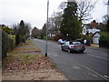
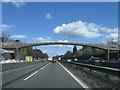
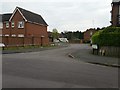
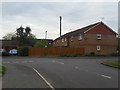

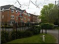
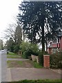
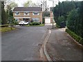
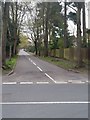
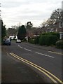

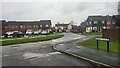
37 photos from this area
Area Information
Key information about the GU15 2NF including its size, population, and administrative classification.
- Area Type
- Postcode
- Area Size
- 9579 m²
- Population
- 1714
- Population Density
- 2172 people/km²
House Prices in GU15 2NF
42
Properties
£221,991
Average Sold Price
£64,000
Lowest Price
£313,000
Highest Price
Showing 42 properties
| Address | Type | Beds | Baths | Last Sale Price | Last Sale Date | |
|---|---|---|---|---|---|---|
| 37 St Catherines Wood, Camberley, GU15 2NF | Flat | 2 | 2 | £228,000 | Aug 2025 | |
| 16 St Catherines Wood, Camberley, GU15 2NF | Flat | 1 | 1 | £200,000 | Dec 2024 | |
| 41 St Catherines Wood, Camberley, GU15 2NF | Flat | 2 | 1 | £245,000 | Mar 2024 | |
| 9 St Catherines Wood, Camberley, GU15 2NF | Flat | - | - | £271,500 | Feb 2024 | |
| 36 St Catherines Wood, Camberley, GU15 2NF | Flat | - | - | £275,000 | Aug 2023 | |
| 12 St Catherines Wood, Camberley, GU15 2NF | Flat | 2 | 1 | £280,000 | Jul 2023 | |
| 8 St Catherines Wood, Camberley, GU15 2NF | Flat | 2 | 2 | £285,000 | Dec 2022 | |
| 26 St Catherines Wood, Camberley, GU15 2NF | Flat | - | - | £300,000 | Nov 2022 | |
| 32 St Catherines Wood, Camberley, GU15 2NF | Flat | 2 | - | £300,000 | Oct 2022 | |
| 5 St Catherines Wood, Camberley, GU15 2NF | Flat | 2 | 2 | £285,000 | Mar 2022 |
Page 1 of 5
Energy Efficiency in GU15 2NF
Amenities
Schools
| Rank | School | Type | Entry gender | Ages |
|---|
Explore more schools in this area
Go to Schools tabDemographics
Household Size
Two person
most common
Accommodation Type
Houses
most common
Tenure
84
majority
Ethnic Group
White
most common
Religion
N/A
most common
Household Composition
N/A
most common
Age
47
median
Adults (30-64 years)
most common
Household Deprivation
N/A
with no deprivation
NS-SEC
53
in Lower managerial occupations
Explore more demographic insights in this area
Go to Demographics tabPlanning
Planning Constraints
- Flood RiskPremium
- Ramsar Wetland SitesPremium
- Area of Outstanding Natural BeautyPremium
- Protected Nature ReservePremium
- Protected WoodlandPremium