Area Overview for GU15 2HS
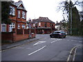
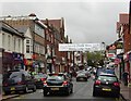
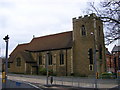
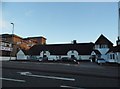
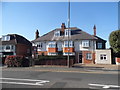
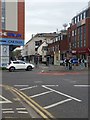
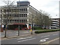
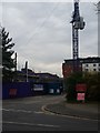
Photos of GU15 2HS


Area Information
GU15 2HS is a small, densely populated residential area in England, home to 2010 residents spread across a compact footprint. With a population density of 1757 people per square kilometre, this postcode area reflects a tight-knit community where proximity to amenities and transport is key. The area’s character is defined by its mix of practical living and accessible infrastructure. Residents benefit from nearby schools, rail stations, and retail hubs, creating a self-contained environment. While the population skews older, with a median age of 47, the area remains active, with a strong focus on family-oriented living. The presence of independent and state schools suggests a balance between educational options. However, the high population density and limited green spaces mean the area prioritises convenience over expansive open spaces. For those seeking a compact, well-connected home without the sprawl of larger towns, GU15 2HS offers a blend of practicality and proximity to essential services.
- Area Type
- Postcode
- Area Size
- Not available
- Population
- 2010
- Population Density
- 1757 people/km²
The property market in GU15 2HS is characterised by a high proportion of flats, with 55% of homes owner-occupied. This suggests a mix of long-term residents and those seeking rental properties, though the exact split between buy-to-let and owner-occupation is not specified. The prevalence of flats indicates a focus on compact, efficient housing, likely catering to families or individuals prioritising convenience over larger living spaces. Given the area’s small size, the housing stock is limited, meaning buyers should consider nearby regions for broader options. The high population density also implies competitive demand for available properties. For those seeking a flat in a connected location, GU15 2HS offers proximity to rail networks and retail, but the limited space may restrict opportunities for larger homes or land-based properties.
House Prices in GU15 2HS
No properties found in this postcode.
Energy Efficiency in GU15 2HS
Daily life in GU15 2HS is shaped by its proximity to essential amenities. Residents can access retail hubs like Sainsburys Camberley and Co-op Camberley, providing grocery and household needs. The rail network offers frequent services to nearby stations, enhancing connectivity for commuting or leisure. While the area lacks detailed data on parks or leisure facilities, the presence of multiple rail and retail points suggests a focus on practicality over expansive recreational spaces. The mix of independent and state schools, combined with nearby airports, creates a lifestyle that balances convenience with accessibility. For those prioritising ease of movement and essential services, GU15 2HS delivers a functional, compact environment.
Amenities
Schools
Residents of GU15 2HS have access to two notable schools: St Tarcisiu’s RC Junior School, a primary school, and St Catherine’s School, an independent institution. These options provide a range of educational pathways, from state-funded early years education to private secondary schooling. The presence of both school types allows families to choose between public and independent education, though no Ofsted ratings are provided to assess performance. The proximity of these schools to the area underscores its appeal for families seeking reliable educational infrastructure. However, the lack of data on school catchment areas or student outcomes means potential buyers should conduct further local research to confirm suitability for their children’s needs.
| Rank | School | Type | Entry gender | Ages |
|---|---|---|---|---|
| 1 | St Tarcisiu's RC Junior School | primary | N/A | N/A |
| 2 | St Catherine's School | independent | N/A | N/A |
Explore more schools in this area
Go to Schools tabDemographics
The community in GU15 2HS is predominantly composed of adults aged 30–64, reflecting a mature demographic with a median age of 47. Home ownership rates stand at 55%, indicating a mix of owner-occupied properties and rental units. The accommodation type is largely flats, suggesting a focus on high-density living. The predominant ethnic group is White, with no specific data provided on other ethnicities. This demographic profile implies a stable, established population with a focus on long-term residency. The absence of detailed diversity metrics means the area’s cultural composition remains less defined in the data. For quality of life, the age range suggests a community with a balance of working-age adults and retirees, potentially supporting local services and amenities. However, the lack of specific data on deprivation or income levels leaves gaps in understanding broader socioeconomic factors.
Household Size
Accommodation Type
Tenure
Ethnic Group
Religion
Household Composition
Age
Household Deprivation
NS-SEC
Explore more demographic insights in this area
Go to Demographics tabPlanning
Planning Constraints
- Flood RiskPremium
- Ramsar Wetland SitesPremium
- Area of Outstanding Natural BeautyPremium
- Protected Nature ReservePremium
- Protected WoodlandPremium