Area Overview for GU15 2AD
Photos of GU15 2AD

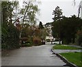
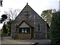

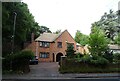
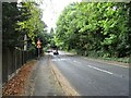
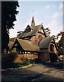
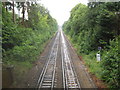
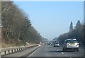
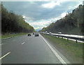
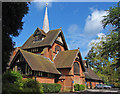
22 photos from this area
Area Information
Key information about the GU15 2AD including its size, population, and administrative classification.
- Area Type
- Postcode
- Area Size
- 2.6 hectares
- Population
- 1563
- Population Density
- 2078 people/km²
House Prices in GU15 2AD
18
Properties
£846,446
Average Sold Price
£497,400
Lowest Price
£1,400,000
Highest Price
Showing 18 properties
| Address | Type | Beds | Baths | Last Sale Price | Last Sale Date | |
|---|---|---|---|---|---|---|
| Crawley Ridge Beeches, Crawley Ridge, Camberley, GU15 2AD | house | 6 | 4 | £1,400,000 | May 2025 | |
| Huntersfield, Crawley Ridge, Camberley, GU15 2AD | Detached | 6 | 3 | £1,175,000 | Aug 2023 | |
| Old Dean Cottage, Crawley Ridge, Camberley, GU15 2AD | Detached | 4 | 2 | £790,000 | Nov 2020 | |
| Augusta House, Crawley Ridge, Camberley, GU15 2AD | Detached | - | - | £900,000 | Sep 2016 | |
| Malden Lodge, Crawley Ridge, Camberley, GU15 2AD | Detached | 4 | 4 | £825,000 | Sep 2014 | |
| Corner House, Crawley Ridge, Camberley, GU15 2AD | house | - | - | £750,000 | May 2010 | |
| Braybourne House, Crawley Ridge, Camberley, GU15 2AD | Detached | - | - | £1,050,000 | Jan 2008 | |
| Tall Trees, Crawley Ridge, Camberley, GU15 2AD | Detached | - | - | £679,950 | Oct 2006 | |
| Littleton House, Crawley Ridge, Camberley, GU15 2AD | Detached | - | - | £890,000 | Apr 2005 | |
| Fyndon Lea, Crawley Ridge, Camberley, GU15 2AD | Detached | 4 | 3 | £650,000 | Nov 2002 |
Page 1 of 2
Energy Efficiency in GU15 2AD
Amenities
Schools
| Rank | School | Type | Entry gender | Ages |
|---|
Explore more schools in this area
Go to Schools tabDemographics
Household Size
Family (3-5 people)
most common
Accommodation Type
Houses
most common
Tenure
91
majority
Ethnic Group
White
most common
Religion
N/A
most common
Household Composition
N/A
most common
Age
47
median
Adults (30-64 years)
most common
Household Deprivation
N/A
with no deprivation
NS-SEC
56
in Lower managerial occupations
Explore more demographic insights in this area
Go to Demographics tabPlanning
Planning Constraints
- Flood RiskPremium
- Ramsar Wetland SitesPremium
- Area of Outstanding Natural BeautyPremium
- Protected Nature ReservePremium
- Protected WoodlandPremium