Area Overview for GU15 1DE
Photos of GU15 1DE
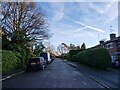
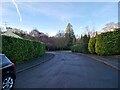
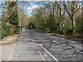
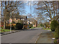
20 photos from this area
Area Information
Key information about the GU15 1DE including its size, population, and administrative classification.
- Area Type
- Postcode
- Area Size
- 4.4 hectares
- Population
- 1644
- Population Density
- 1558 people/km²
House Prices in GU15 1DE
16
Properties
£613,740
Average Sold Price
£273,500
Lowest Price
£1,015,000
Highest Price
Showing 16 properties
| Address | Type | Beds | Baths | Last Sale Price | Last Sale Date | |
|---|---|---|---|---|---|---|
| 10 Prior Croft Close, Camberley, GU15 1DE | Detached | 5 | 4 | £1,015,000 | Aug 2021 | |
| 6 Prior Croft Close, Camberley, GU15 1DE | house | - | - | £765,000 | Jul 2017 | |
| 15 Prior Croft Close, Camberley, GU15 1DE | house | - | - | £750,500 | Mar 2016 | |
| 18 Prior Croft Close, Camberley, GU15 1DE | Detached | 5 | - | £673,000 | Jun 2015 | |
| 16 Prior Croft Close, Camberley, GU15 1DE | Detached | 5 | - | £760,000 | May 2015 | |
| 4 Prior Croft Close, Camberley, GU15 1DE | house | - | - | £675,000 | Sep 2014 | |
| 2 Prior Croft Close, Camberley, GU15 1DE | house | - | - | £700,000 | Jan 2014 | |
| 12 Prior Croft Close, Camberley, GU15 1DE | Detached | 5 | 2 | £554,000 | Apr 2013 | |
| 7 Prior Croft Close, Camberley, GU15 1DE | house | - | - | £578,000 | Sep 2004 | |
| 1 Prior Croft Close, Camberley, GU15 1DE | Detached | 5 | - | £308,334 | Sep 2003 |
Page 1 of 2
Energy Efficiency in GU15 1DE
Amenities
Schools
| Rank | School | Type | Entry gender | Ages |
|---|
Explore more schools in this area
Go to Schools tabDemographics
Household Size
Family (3-5 people)
most common
Accommodation Type
Houses
most common
Tenure
91
majority
Ethnic Group
White
most common
Religion
N/A
most common
Household Composition
N/A
most common
Age
47
median
Adults (30-64 years)
most common
Household Deprivation
N/A
with no deprivation
NS-SEC
52
in Lower managerial occupations
Explore more demographic insights in this area
Go to Demographics tabPlanning
Planning Constraints
- Flood RiskPremium
- Ramsar Wetland SitesPremium
- Area of Outstanding Natural BeautyPremium
- Protected Nature ReservePremium
- Protected WoodlandPremium