Area Overview for GU14 9WU
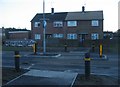
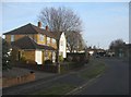
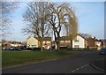
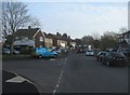
Photos of GU14 9WU


Area Information
GU14 9WU is a small residential postcode area in England, home to 1981 residents. It is a compact cluster of homes, predominantly owner-occupied, with a median age of 47 and a strong presence of adults aged 30–64. The area’s character is defined by its proximity to key transport links and essential services. Residents benefit from excellent broadband connectivity, scoring 100 out of 100, ensuring seamless digital access for work or leisure. Nearby, Farnborough Railway Station and Frimley Railway Station provide regular commuter routes, while Farnborough Airport and Blackbushe Airport offer regional travel options. The area’s schools, including the outstanding Grange Community Junior School, cater to families. Daily life here balances suburban tranquility with practical access to retail, dining, and transport hubs. With low crime risk and no environmental constraints, GU14 9WU offers a stable, well-connected environment for those seeking a settled lifestyle.
- Area Type
- Postcode
- Area Size
- Not available
- Population
- 1981
- Population Density
- 5017 people/km²
GU14 9WU is primarily an owner-occupied area, with 68% of homes owned by residents rather than rented. The accommodation type is predominantly houses, which is uncommon in many modern developments. This suggests a traditional, family-oriented housing stock, likely with larger properties compared to flats. The small size of the postcode area means the property market is limited in scale, with fewer options for buyers. However, the high home ownership rate indicates strong community ties and long-term residency. For buyers, this could mean competition for available homes, but also a stable market with fewer speculative investments. The focus on houses may appeal to those seeking space and privacy, though the limited number of properties could require a broader search in nearby areas.
House Prices in GU14 9WU
No properties found in this postcode.
Energy Efficiency in GU14 9WU
Living in GU14 9WU offers access to a mix of retail, transport, and leisure options. Nearby shops include Co-op Cove, Tesco Farnborough, and M&S Oakfarm BP, providing everyday convenience. The area’s rail network, with stations like Farnborough and Frimley, connects residents to broader regional hubs, while nearby airports cater to travel needs. Though the data does not mention parks or leisure facilities, the proximity to rail and retail suggests a practical, service-oriented lifestyle. The presence of an outstanding primary school and low crime risk further enhance the area’s appeal. Residents can enjoy a balance of local amenities and easy access to larger urban centres, making it suitable for those who value both convenience and connectivity.
Amenities
Schools
The nearest school to GU14 9WU is Grange Community Junior School, a primary school with an outstanding Ofsted rating. This indicates high-quality education for younger children, though no secondary schools are listed in the data. Families with children may need to look further afield for secondary education, which could impact the area’s appeal for those prioritising a full range of schooling. The presence of a top-rated primary school is a significant advantage, offering parents confidence in their child’s early education. However, the lack of secondary school options means buyers should consider proximity to other schools in the wider region.
| Rank | School | Type | Entry gender | Ages |
|---|
Explore more schools in this area
Go to Schools tabDemographics
The population of GU14 9WU is 1981, with a median age of 47. The majority of residents are adults aged 30–64, reflecting a mature, established community. Home ownership is high, at 68%, and the area is dominated by houses rather than flats or apartments. The predominant ethnic group is White, though no specific diversity statistics are provided. The age profile suggests a population that is largely settled, with fewer young families or retirees compared to other areas. This demographic mix may influence local services and amenities, which are tailored to adult needs. The absence of detailed deprivation data means the quality of life here is inferred from the availability of services and low safety risks. For buyers, this profile indicates a community focused on stability and long-term living.
Household Size
Accommodation Type
Tenure
Ethnic Group
Religion
Household Composition
Age
Household Deprivation
NS-SEC
Explore more demographic insights in this area
Go to Demographics tabPlanning
Planning Constraints
- Flood RiskPremium
- Ramsar Wetland SitesPremium
- Area of Outstanding Natural BeautyPremium
- Protected Nature ReservePremium
- Protected WoodlandPremium