Area Overview for GU14 9LP
Photos of GU14 9LP
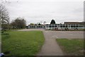
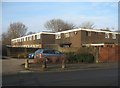
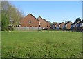
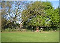
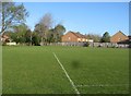
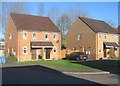
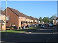
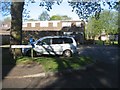
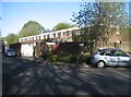
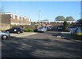
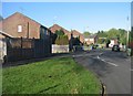
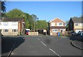
100 photos from this area
Area Information
Key information about the GU14 9LP including its size, population, and administrative classification.
- Area Type
- Postcode
- Area Size
- 1.3 hectares
- Population
- 1540
- Population Density
- 5125 people/km²
House Prices in GU14 9LP
46
Properties
£232,836
Average Sold Price
£58,000
Lowest Price
£375,000
Highest Price
Showing 46 properties
| Address | Type | Beds | Baths | Last Sale Price | Last Sale Date | |
|---|---|---|---|---|---|---|
| 45 Rother Road, Farnborough, GU14 9LP | house | - | - | £356,000 | Feb 2025 | |
| 44 Rother Road, Farnborough, GU14 9LP | Terraced | 3 | 2 | £353,000 | Jul 2023 | |
| 39 Rother Road, Farnborough, GU14 9LP | Terraced | 3 | 1 | £322,500 | Feb 2023 | |
| 6 Rother Road, Farnborough, GU14 9LP | Terraced | 3 | 1 | £375,000 | Dec 2022 | |
| 26 Rother Road, Farnborough, GU14 9LP | house | - | - | £240,000 | Jan 2022 | |
| 37 Rother Road, Farnborough, GU14 9LP | house | - | - | £350,000 | Nov 2021 | |
| 36 Rother Road, Farnborough, GU14 9LP | house | - | - | £317,500 | Mar 2021 | |
| 17 Rother Road, Farnborough, GU14 9LP | Terraced | 3 | 1 | £290,000 | Feb 2020 | |
| 15 Rother Road, Farnborough, GU14 9LP | Terraced | 3 | - | £280,000 | Mar 2019 | |
| 3 Rother Road, Farnborough, GU14 9LP | Terraced | 3 | - | £315,000 | Sep 2018 |
Page 1 of 5
Energy Efficiency in GU14 9LP
Amenities
Schools
| Rank | School | Type | Entry gender | Ages |
|---|
Explore more schools in this area
Go to Schools tabDemographics
Household Size
Family (3-5 people)
most common
Accommodation Type
Houses
most common
Tenure
84
majority
Ethnic Group
White
most common
Religion
N/A
most common
Household Composition
N/A
most common
Age
47
median
Adults (30-64 years)
most common
Household Deprivation
N/A
with no deprivation
NS-SEC
31
in Lower managerial occupations
Explore more demographic insights in this area
Go to Demographics tabPlanning
Planning Constraints
- Flood RiskPremium
- Ramsar Wetland SitesPremium
- Area of Outstanding Natural BeautyPremium
- Protected Nature ReservePremium
- Protected WoodlandPremium