Area Overview for GU14 9LL
Photos of GU14 9LL
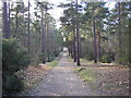
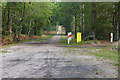
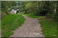
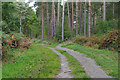
43 photos from this area
Area Information
Key information about the GU14 9LL including its size, population, and administrative classification.
- Area Type
- Postcode
- Area Size
- 1.4 hectares
- Population
- 1210
- Population Density
- 2679 people/km²
House Prices in GU14 9LL
54
Properties
£137,911
Average Sold Price
£46,000
Lowest Price
£340,000
Highest Price
Showing 54 properties
| Address | Type | Beds | Baths | Last Sale Price | Last Sale Date | |
|---|---|---|---|---|---|---|
| 23 Bartons Way, Farnborough, GU14 9LL | Flat | 1 | 1 | £150,000 | Aug 2025 | |
| 6 Bartons Way, Farnborough, GU14 9LL | Flat | - | - | £108,000 | Jun 2025 | |
| 38 Bartons Way, Farnborough, GU14 9LL | Terraced | 3 | 1 | £340,000 | Jan 2023 | |
| 39 Bartons Way, Farnborough, GU14 9LL | house | 3 | 1 | £332,000 | Aug 2022 | |
| 34 Bartons Way, Farnborough, GU14 9LL | Flat | - | - | £155,000 | Apr 2021 | |
| 22 Bartons Way, Farnborough, GU14 9LL | Flat | - | - | £155,000 | Dec 2020 | |
| 55 Bartons Way, Farnborough, GU14 9LL | Flat | - | - | £153,500 | Jan 2020 | |
| 27 Bartons Way, Farnborough, GU14 9LL | Flat | 1 | 1 | £165,000 | Jun 2017 | |
| 17 Bartons Way, Farnborough, GU14 9LL | Flat | - | - | £139,450 | May 2015 | |
| 21 Bartons Way, Farnborough, GU14 9LL | Flat | - | - | £125,000 | Oct 2014 |
Page 1 of 6
Energy Efficiency in GU14 9LL
Amenities
Schools
| Rank | School | Type | Entry gender | Ages |
|---|
Explore more schools in this area
Go to Schools tabDemographics
Household Size
Family (3-5 people)
most common
Accommodation Type
Houses
most common
Tenure
73
majority
Ethnic Group
White
most common
Religion
N/A
most common
Household Composition
N/A
most common
Age
47
median
Adults (30-64 years)
most common
Household Deprivation
N/A
with no deprivation
NS-SEC
28
in Lower managerial occupations
Explore more demographic insights in this area
Go to Demographics tabPlanning
Planning Constraints
- Flood RiskPremium
- Ramsar Wetland SitesPremium
- Area of Outstanding Natural BeautyPremium
- Protected Nature ReservePremium
- Protected WoodlandPremium