Area Overview for GU14 9AW
Photos of GU14 9AW
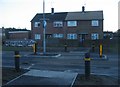
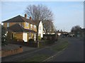
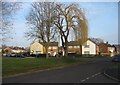
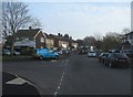
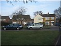
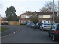
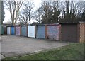
100 photos from this area
Area Information
Key information about the GU14 9AW including its size, population, and administrative classification.
- Area Type
- Postcode
- Area Size
- 8903 m²
- Population
- 1477
- Population Density
- 4814 people/km²
House Prices in GU14 9AW
32
Properties
£150,579
Average Sold Price
£45,000
Lowest Price
£250,000
Highest Price
Showing 32 properties
| Address | Type | Beds | Baths | Last Sale Price | Last Sale Date | |
|---|---|---|---|---|---|---|
| 77 Ratcliffe Road, Farnborough, GU14 9AW | Maisonette | 2 | 1 | £250,000 | Jun 2025 | |
| 67 Ratcliffe Road, Farnborough, GU14 9AW | Maisonette | 2 | 1 | £230,000 | May 2021 | |
| 99 Ratcliffe Road, Farnborough, GU14 9AW | Maisonette | 2 | 1 | £225,000 | Dec 2019 | |
| 121 Ratcliffe Road, Farnborough, GU14 9AW | Maisonette | - | - | £210,500 | Nov 2016 | |
| 75 Ratcliffe Road, Farnborough, GU14 9AW | Flat | - | - | £170,000 | Aug 2014 | |
| 115 Ratcliffe Road, Farnborough, GU14 9AW | Maisonette | - | - | £154,000 | Mar 2012 | |
| 101 Ratcliffe Road, Farnborough, GU14 9AW | Flat | - | - | £143,000 | Oct 2008 | |
| 125 Ratcliffe Road, Farnborough, GU14 9AW | Flat | - | - | £145,000 | Aug 2006 | |
| 69 Ratcliffe Road, Farnborough, GU14 9AW | Maisonette | 2 | - | £94,500 | Jun 2006 | |
| 97 Ratcliffe Road, Farnborough, GU14 9AW | Flat | - | - | £80,000 | Jan 2000 |
Page 1 of 4
Energy Efficiency in GU14 9AW
Amenities
Schools
| Rank | School | Type | Entry gender | Ages |
|---|
Explore more schools in this area
Go to Schools tabDemographics
Household Size
Family (3-5 people)
most common
Accommodation Type
Houses
most common
Tenure
55
majority
Ethnic Group
White
most common
Religion
N/A
most common
Household Composition
N/A
most common
Age
47
median
Adults (30-64 years)
most common
Household Deprivation
N/A
with no deprivation
NS-SEC
22
in Lower managerial occupations
Explore more demographic insights in this area
Go to Demographics tabPlanning
Planning Constraints
- Flood RiskPremium
- Ramsar Wetland SitesPremium
- Area of Outstanding Natural BeautyPremium
- Protected Nature ReservePremium
- Protected WoodlandPremium