Area Overview for GU14 8PD
Photos of GU14 8PD

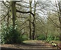
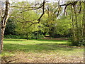
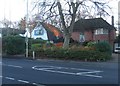
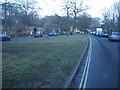
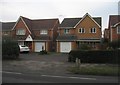
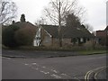
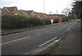

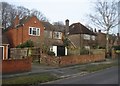
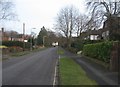
100 photos from this area
Area Information
Key information about the GU14 8PD including its size, population, and administrative classification.
- Area Type
- Postcode
- Area Size
- 4558 m²
- Population
- 1320
- Population Density
- 4760 people/km²
House Prices in GU14 8PD
10
Properties
£237,217
Average Sold Price
£52,000
Lowest Price
£440,000
Highest Price
Showing 10 properties
| Address | Type | Beds | Baths | Last Sale Price | Last Sale Date | |
|---|---|---|---|---|---|---|
| 184 West Heath Road, Farnborough, GU14 8PD | house | - | - | £440,000 | Jun 2021 | |
| 157 West Heath Road, Farnborough, GU14 8PD | Semi-detached | 3 | 1 | £338,000 | Jul 2020 | |
| 190 West Heath Road, Farnborough, GU14 8PD | Maisonette | - | - | £239,950 | Mar 2017 | |
| 151 West Heath Road, Farnborough, GU14 8PD | Detached | 4 | 3 | £186,000 | Sep 2014 | |
| 182 West Heath Road, Farnborough, GU14 8PD | Semi-detached | 3 | 1 | £280,000 | May 2013 | |
| 153 West Heath Road, Farnborough, GU14 8PD | Maisonette | 2 | - | £245,000 | Sep 2007 | |
| 155 West Heath Road, Farnborough, GU14 8PD | Semi-detached | - | - | £223,000 | Nov 2006 | |
| 186 West Heath Road, Farnborough, GU14 8PD | Maisonette | 2 | 1 | £131,000 | Jan 2006 | |
| 188 West Heath Road, Farnborough, GU14 8PD | Flat | - | - | £52,000 | Apr 1997 | |
| 192 West Heath Road, Farnborough, GU14 8PD | Flat | - | - | - | - |
Energy Efficiency in GU14 8PD
Amenities
Schools
| Rank | School | Type | Entry gender | Ages |
|---|
Explore more schools in this area
Go to Schools tabDemographics
Household Size
Two person
most common
Accommodation Type
Houses
most common
Tenure
78
majority
Ethnic Group
White
most common
Religion
N/A
most common
Household Composition
N/A
most common
Age
47
median
Adults (30-64 years)
most common
Household Deprivation
N/A
with no deprivation
NS-SEC
38
in Lower managerial occupations
Explore more demographic insights in this area
Go to Demographics tabPlanning
Planning Constraints
- Flood RiskPremium
- Ramsar Wetland SitesPremium
- Area of Outstanding Natural BeautyPremium
- Protected Nature ReservePremium
- Protected WoodlandPremium