Area Overview for GU14 8NF
Photos of GU14 8NF
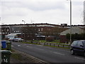
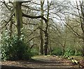
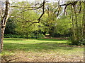
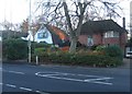
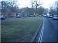
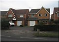

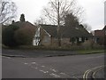
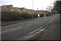

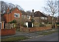
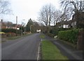
100 photos from this area
Area Information
Key information about the GU14 8NF including its size, population, and administrative classification.
- Area Type
- Postcode
- Area Size
- 1.7 hectares
- Population
- 1532
- Population Density
- 2595 people/km²
House Prices in GU14 8NF
24
Properties
£429,875
Average Sold Price
£92,500
Lowest Price
£675,000
Highest Price
Showing 24 properties
| Address | Type | Beds | Baths | Last Sale Price | Last Sale Date | |
|---|---|---|---|---|---|---|
| 32 Pierrefondes Avenue, Farnborough, GU14 8NF | Retail | 4 | 1 | £675,000 | Aug 2022 | |
| 44 Pierrefondes Avenue, Farnborough, GU14 8NF | house | - | - | £635,000 | Sep 2021 | |
| 20 Pierrefondes Avenue, Farnborough, GU14 8NF | Detached | 4 | 2 | £640,000 | Jul 2020 | |
| 4 Pierrefondes Avenue, Farnborough, GU14 8NF | Semi-detached | 4 | 2 | £475,000 | Jul 2020 | |
| 2 Pierrefondes Avenue, Farnborough, GU14 8NF | Semi-detached | 3 | 1 | £530,000 | Nov 2019 | |
| 42 Pierrefondes Avenue, Farnborough, GU14 8NF | Semi-detached | 4 | 1 | £500,000 | Nov 2017 | |
| 30 Pierrefondes Avenue, Farnborough, GU14 8NF | house | - | - | £470,000 | May 2010 | |
| 10 Pierrefondes Avenue, Farnborough, GU14 8NF | Semi-detached | - | - | £308,000 | Nov 2005 | |
| Chestnut House, 2B Pierrefondes Avenue, Farnborough, GU14 8NF | Detached | - | - | £345,000 | Oct 2005 | |
| 6 Pierrefondes Avenue, Farnborough, GU14 8NF | Semi-detached | - | - | £270,000 | Aug 2004 |
Page 1 of 3
Energy Efficiency in GU14 8NF
Amenities
Schools
| Rank | School | Type | Entry gender | Ages |
|---|
Explore more schools in this area
Go to Schools tabDemographics
Household Size
Two person
most common
Accommodation Type
Houses
most common
Tenure
78
majority
Ethnic Group
White
most common
Religion
N/A
most common
Household Composition
N/A
most common
Age
47
median
Adults (30-64 years)
most common
Household Deprivation
N/A
with no deprivation
NS-SEC
49
in Lower managerial occupations
Explore more demographic insights in this area
Go to Demographics tabPlanning
Planning Constraints
- Flood RiskPremium
- Ramsar Wetland SitesPremium
- Area of Outstanding Natural BeautyPremium
- Protected Nature ReservePremium
- Protected WoodlandPremium