Area Overview for GU14 8LW
Photos of GU14 8LW
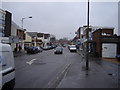
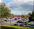
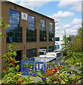
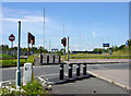
100 photos from this area
Area Information
Key information about the GU14 8LW including its size, population, and administrative classification.
- Area Type
- Postcode
- Area Size
- 1.1 hectares
- Population
- 1568
- Population Density
- 1596 people/km²
House Prices in GU14 8LW
29
Properties
£180,540
Average Sold Price
£94,950
Lowest Price
£345,000
Highest Price
Showing 29 properties
| Address | Type | Beds | Baths | Last Sale Price | Last Sale Date | |
|---|---|---|---|---|---|---|
| 52 Cromwell Way, Farnborough, GU14 8LW | Terraced | 3 | 1 | £345,000 | Aug 2023 | |
| 54 Cromwell Way, Farnborough, GU14 8LW | Terraced | 3 | - | £276,000 | Apr 2020 | |
| 46 Cromwell Way, Farnborough, GU14 8LW | Terraced | - | - | £194,000 | Jan 2020 | |
| 66 Cromwell Way, Farnborough, GU14 8LW | Terraced | 2 | 1 | £272,000 | Mar 2019 | |
| 78 Cromwell Way, Farnborough, GU14 8LW | Maisonette | 1 | - | £125,000 | Feb 2013 | |
| 86 Cromwell Way, Farnborough, GU14 8LW | Maisonette | 1 | 1 | £124,500 | Nov 2006 | |
| 44 Cromwell Way, Farnborough, GU14 8LW | Terraced | 1 | - | £159,000 | Feb 2006 | |
| 90 Cromwell Way, Farnborough, GU14 8LW | Maisonette | 1 | 1 | £94,950 | Jul 2003 | |
| 42 Cromwell Way, Farnborough, GU14 8LW | Terraced | 3 | - | £120,000 | Oct 2001 | |
| 60 Cromwell Way, Farnborough, GU14 8LW | Terraced | 2 | 1 | £94,950 | Jun 2000 |
Page 1 of 3
Energy Efficiency in GU14 8LW
Amenities
Schools
| Rank | School | Type | Entry gender | Ages |
|---|
Explore more schools in this area
Go to Schools tabDemographics
Household Size
Two person
most common
Accommodation Type
Houses
most common
Tenure
83
majority
Ethnic Group
White
most common
Religion
N/A
most common
Household Composition
N/A
most common
Age
47
median
Adults (30-64 years)
most common
Household Deprivation
N/A
with no deprivation
NS-SEC
44
in Lower managerial occupations
Explore more demographic insights in this area
Go to Demographics tabPlanning
Planning Constraints
- Flood RiskPremium
- Ramsar Wetland SitesPremium
- Area of Outstanding Natural BeautyPremium
- Protected Nature ReservePremium
- Protected WoodlandPremium