Area Overview for GU14 8LB
Photos of GU14 8LB
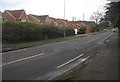
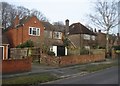
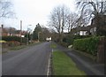
100 photos from this area
Area Information
Key information about the GU14 8LB including its size, population, and administrative classification.
- Area Type
- Postcode
- Area Size
- 6331 m²
- Population
- 1320
- Population Density
- 4760 people/km²
House Prices in GU14 8LB
10
Properties
£372,825
Average Sold Price
£142,000
Lowest Price
£585,000
Highest Price
Showing 10 properties
| Address | Type | Beds | Baths | Last Sale Price | Last Sale Date | |
|---|---|---|---|---|---|---|
| 130 Prospect Road, Farnborough, GU14 8LB | Detached | 3 | 1 | £585,000 | Dec 2024 | |
| 140 Prospect Road, Farnborough, GU14 8LB | Semi-detached | 3 | 2 | £495,000 | Nov 2023 | |
| 138 Prospect Road, Farnborough, GU14 8LB | Semi-detached | 3 | 2 | £365,000 | Jan 2022 | |
| 128 Prospect Road, Farnborough, GU14 8LB | Detached | 4 | - | £400,000 | Jun 2016 | |
| 136 Prospect Road, Farnborough, GU14 8LB | house | - | - | £249,950 | Sep 2002 | |
| 126A Prospect Road, Farnborough, GU14 8LB | Detached | - | - | £142,000 | Mar 1999 | |
| Buckland, 126 Prospect Road, Farnborough, GU14 8LB | Bungalow | 2 | 1 | - | - | |
| Foxhill, 132 Prospect Road, Farnborough, GU14 8LB | Bungalow | 3 | 1 | - | - | |
| Lamayne, 134 Prospect Road, Farnborough, GU14 8LB | Bungalow | 2 | 1 | - | - | |
| Wychwood, 124 Prospect Road, Farnborough, GU14 8LB | house | - | - | - | - |
Energy Efficiency in GU14 8LB
Amenities
Schools
| Rank | School | Type | Entry gender | Ages |
|---|
Explore more schools in this area
Go to Schools tabDemographics
Household Size
Two person
most common
Accommodation Type
Houses
most common
Tenure
78
majority
Ethnic Group
White
most common
Religion
N/A
most common
Household Composition
N/A
most common
Age
47
median
Adults (30-64 years)
most common
Household Deprivation
N/A
with no deprivation
NS-SEC
38
in Lower managerial occupations
Explore more demographic insights in this area
Go to Demographics tabPlanning
Planning Constraints
- Flood RiskPremium
- Ramsar Wetland SitesPremium
- Area of Outstanding Natural BeautyPremium
- Protected Nature ReservePremium
- Protected WoodlandPremium