Area Overview for GU14 7PD
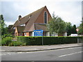
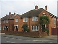
Photos of GU14 7PD


Area Information
Living in GU14 7PD offers a compact, residential experience within a small cluster of 164 square metres, home to 1,710 residents. This postcode area is defined by its proximity to practical amenities and a low population density, which suggests a quiet, community-focused environment. The area’s safety profile is strong, with a low crime risk score of 74 and no flood or environmental constraints. Daily life here is likely shaped by the surrounding infrastructure, including nearby rail stations and retail hubs. While the area is small, its connectivity to Farnborough and surrounding towns via rail and road may make it appealing for commuters. The demographic mix—primarily adults aged 30–64, with a high home ownership rate—hints at a stable, family-oriented community. For those seeking a balance between seclusion and accessibility, GU14 7PD provides a foundation for a low-maintenance lifestyle, with minimal environmental risks and a focus on practical living.
- Area Type
- Postcode
- Area Size
- 164 m²
- Population
- 1710
- Population Density
- 4340 people/km²
The property market in GU14 7PD is characterised by a high rate of home ownership—68%—indicating that most properties are owner-occupied rather than rented. The accommodation type is predominantly houses, which may reflect the area’s appeal to families or individuals seeking more space. Given the small size of the postcode area, the housing stock is likely limited, making it a niche market for buyers. The high home ownership rate also suggests a stable, long-term resident base, which can influence property values and demand. For buyers, this means competition may be lower compared to larger urban areas, but proximity to nearby amenities such as rail stations and retail hubs could enhance the area’s appeal. However, the limited size of GU14 7PD means buyers should consider the surrounding regions for more options.
House Prices in GU14 7PD
No properties found in this postcode.
Energy Efficiency in GU14 7PD
Residents of GU14 7PD have access to practical amenities within reach, including retail options like Sainsburys Farnborough, Asda Farnborough, and Iceland Farnborough. These stores provide daily essentials, making shopping convenient for locals. The area’s rail network, with stations such as Farnborough Railway Station and Frimley Railway Station, connects residents to nearby towns and cities, enhancing mobility. Nearby airports, Farnborough Airport and Blackbushe Airport, offer additional travel options. While the data does not mention parks or leisure facilities, the presence of multiple retail and transport hubs suggests a focus on functionality over leisure. The compact size of the area means amenities are likely within walking or short driving distance, supporting a lifestyle that prioritises convenience and accessibility over expansive recreational spaces.
Amenities
Schools
| Rank | School | Type | Entry gender | Ages |
|---|
Explore more schools in this area
Go to Schools tabDemographics
The community in GU14 7PD is predominantly composed of adults aged 30–64, with a median age of 47. This suggests a mature population, likely with established careers and families. Home ownership is high at 68%, indicating a strong presence of long-term residents rather than transient renters. The accommodation type is primarily houses, which aligns with the area’s residential character and may appeal to those seeking space and privacy. The predominant ethnic group is White, reflecting the broader demographic patterns of the region. While the data does not specify deprivation levels, the high home ownership and low crime risk imply a relatively stable quality of life. The absence of detailed diversity metrics means the community’s cultural composition remains less defined, but the age profile and housing stock suggest a cohesive, settled population.
Household Size
Accommodation Type
Tenure
Ethnic Group
Religion
Household Composition
Age
Household Deprivation
NS-SEC
Explore more demographic insights in this area
Go to Demographics tabPlanning
Planning Constraints
- Flood RiskPremium
- Ramsar Wetland SitesPremium
- Area of Outstanding Natural BeautyPremium
- Protected Nature ReservePremium
- Protected WoodlandPremium