Area Overview for GU14 7NG
Photos of GU14 7NG


Area Information
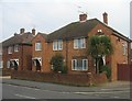
Living in GU14 7NG offers a quiet, residential experience within a small cluster of homes. With a population of 1,710, this area is compact but well-served by nearby amenities. The community is largely composed of adults aged 30–64, reflecting a mature demographic with a median age of 47. Most residents own their homes, with 68% of properties owner-occupied, and the housing stock is predominantly single-family houses. This suggests a stable, long-term resident base. The area’s low flood risk and absence of protected natural sites make it practical for families and professionals seeking a balanced lifestyle. Proximity to Farnborough’s rail network and two nearby airports enhances connectivity, while local shops and services within walking distance support daily convenience. GU14 7NG is a place where comfort meets practicality, offering a calm environment without sacrificing access to essential infrastructure.
- Area Type
- Postcode
- Area Size
- Not available
- Population
- 1710
- Population Density
- 4340 people/km²
The property market in GU14 7NG is characterised by a high proportion of owner-occupied homes, with 68% of properties owned by residents. This suggests a stable, long-term demographic rather than a transient rental market. The accommodation type is predominantly houses, which are typically larger and more suited to families or professionals requiring private space. Given the area’s small size, the housing stock is limited, meaning buyers may need to consider nearby areas for more options. The focus on owner-occupation indicates strong community ties and potential for long-term investment. However, the small population and limited property numbers may also mean competition for available homes. For buyers, this area offers a chance to secure a family home in a low-risk, low-maintenance environment, though proximity to larger towns like Farnborough could be necessary for broader property choices.
House Prices in GU14 7NG
No properties found in this postcode.
Energy Efficiency in GU14 7NG
GU14 7NG’s residents have access to a range of local amenities within practical reach. The area is served by five retail outlets, including Sainsburys Farnborough, Iceland Farnborough, and Asda Farnborough, ensuring everyday shopping needs are met. Nearby rail stations, such as Farnborough and Frimley, provide easy access to public transport, while two airports—Farnborough and Blackbushe—offer regional travel options. Although the area is small, its proximity to Farnborough means additional leisure and dining choices are available in the surrounding town. The presence of multiple retail and transport hubs suggests a lifestyle that balances local convenience with broader opportunities. For those prioritising self-sufficiency, the cluster of shops and transport links makes GU14 7NG a practical choice for daily living.
Amenities
Schools
| Rank | School | Type | Entry gender | Ages |
|---|
Explore more schools in this area
Go to Schools tabDemographics
GU14 7NG’s population of 1,710 is primarily composed of adults aged 30–64, with a median age of 47. This suggests a community of established professionals and families, rather than students or retirees. Home ownership is strong, with 68% of residents living in properties they own, indicating a stable housing market. The area’s accommodation is almost entirely houses, reflecting a preference for larger, private living spaces. The predominant ethnic group is White, with no data provided on other demographics. The age profile and high home ownership rate suggest a low turnover of residents, fostering a sense of continuity. While no specific deprivation data is available, the absence of planning constraints and low crime risk implies a relatively high quality of life. This makes GU14 7NG appealing to those seeking a settled, low-stress environment.
Household Size
Accommodation Type
Tenure
Ethnic Group
Religion
Household Composition
Age
Household Deprivation
NS-SEC
Explore more demographic insights in this area
Go to Demographics tabPlanning
Planning Constraints
- Flood RiskPremium
- Ramsar Wetland SitesPremium
- Area of Outstanding Natural BeautyPremium
- Protected Nature ReservePremium
- Protected WoodlandPremium