Area Overview for GU14 6QN
Photos of GU14 6QN
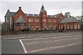
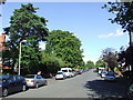
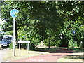
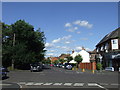
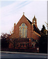
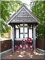
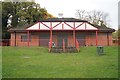
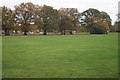
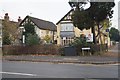
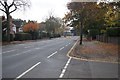
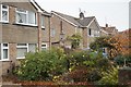
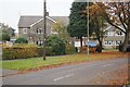
100 photos from this area
Area Information
Key information about the GU14 6QN including its size, population, and administrative classification.
- Area Type
- Postcode
- Area Size
- 2.9 hectares
- Population
- 1837
- Population Density
- 3720 people/km²
House Prices in GU14 6QN
26
Properties
£535,367
Average Sold Price
£215,000
Lowest Price
£785,000
Highest Price
Showing 26 properties
| Address | Type | Beds | Baths | Last Sale Price | Last Sale Date | |
|---|---|---|---|---|---|---|
| 91 Canterbury Road, Farnborough, GU14 6QN | Detached | 3 | 1 | £580,000 | May 2025 | |
| 100 Canterbury Road, Farnborough, GU14 6QN | house | 4 | 3 | £770,000 | Oct 2024 | |
| 112 Canterbury Road, Farnborough, GU14 6QN | Detached | 3 | 1 | £535,000 | Jul 2023 | |
| 87 Canterbury Road, Farnborough, GU14 6QN | Detached | 3 | 2 | £600,000 | Feb 2023 | |
| 98 Canterbury Road, Farnborough, GU14 6QN | house | - | - | £576,000 | Jun 2021 | |
| 108 Canterbury Road, Farnborough, GU14 6QN | Bungalow | - | - | £650,000 | Jan 2021 | |
| 104 Canterbury Road, Farnborough, GU14 6QN | Detached | 4 | 2 | £785,000 | Oct 2018 | |
| 85 Canterbury Road, Farnborough, GU14 6QN | Detached | 4 | 2 | £635,000 | Feb 2017 | |
| 81 Canterbury Road, Farnborough, GU14 6QN | Detached | 4 | 1 | £612,500 | Dec 2016 | |
| 95 Canterbury Road, Farnborough, GU14 6QN | Detached | 4 | 3 | £455,000 | Jul 2013 |
Page 1 of 3
Energy Efficiency in GU14 6QN
Amenities
Schools
| Rank | School | Type | Entry gender | Ages |
|---|
Explore more schools in this area
Go to Schools tabDemographics
Household Size
Two person
most common
Accommodation Type
Houses
most common
Tenure
73
majority
Ethnic Group
White
most common
Religion
N/A
most common
Household Composition
N/A
most common
Age
47
median
Adults (30-64 years)
most common
Household Deprivation
N/A
with no deprivation
NS-SEC
47
in Lower managerial occupations
Explore more demographic insights in this area
Go to Demographics tabPlanning
Planning Constraints
- Flood RiskPremium
- Ramsar Wetland SitesPremium
- Area of Outstanding Natural BeautyPremium
- Protected Nature ReservePremium
- Protected WoodlandPremium