Area Overview for GU14 6JW
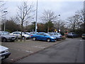
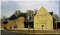
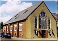
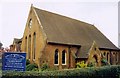
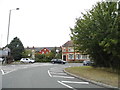
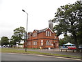
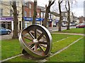
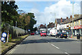
Photos of GU14 6JW
Area Information
GU14 6JW is a compact residential postcode in England, covering 3,436 square metres and home to 1,374 residents. Its high population density of 399,935 people per square kilometre reflects a tightly knit community. This small area is defined by its residential character, with homes predominantly occupied by owners rather than renters. The median age of 47 suggests a mature population, with adults aged 30–64 forming the largest demographic group. Daily life here is shaped by proximity to essential services, including multiple schools, retail outlets, and transport links. The area’s size means it is not a sprawling suburb but a focused cluster of homes, ideal for those seeking a close-knit environment with easy access to nearby amenities. Its location near Farnborough and surrounding towns offers a balance of local convenience and regional connectivity. For buyers, this area presents a blend of practicality and community-focused living, with no major environmental constraints or planning restrictions to complicate property ownership.
- Area Type
- Postcode
- Area Size
- 3436 m²
- Population
- 1374
- Population Density
- 6515 people/km²
The property market in GU14 6JW is dominated by owner-occupied homes, with 68% of properties owned outright by residents. This high home ownership rate suggests a community of long-term residents rather than a transient rental market. The area is primarily composed of houses, which are more common than flats or apartments. This housing stock is typical of suburban or semi-rural areas, offering larger living spaces compared to urban centres. The small size of the postcode means the housing stock is limited, and buyers may need to consider nearby areas for additional options. The absence of planning constraints or environmental restrictions makes this area attractive for those seeking a stable, family-friendly environment. For buyers, the focus on owner-occupation and traditional housing types may appeal to those prioritising long-term investment over short-term rental opportunities.
House Prices in GU14 6JW
Showing 20 properties
| Address | Type | Beds | Baths | Last Sale Price | Last Sale Date | |
|---|---|---|---|---|---|---|
| 75 Queens Road, Farnborough, GU14 6JW | Terraced | 2 | 1 | £350,000 | Mar 2025 | |
| 95 Queens Road, Farnborough, GU14 6JW | Terraced | 2 | 1 | £384,000 | Mar 2023 | |
| 103 Queens Road, Farnborough, GU14 6JW | house | 3 | - | £337,000 | Dec 2021 | |
| 93 Queens Road, Farnborough, GU14 6JW | house | - | - | £300,000 | Mar 2021 | |
| 79 Queens Road, Farnborough, GU14 6JW | house | 3 | - | £270,000 | Apr 2019 | |
| 81 Queens Road, Farnborough, GU14 6JW | Terraced | 2 | 1 | £290,000 | Sep 2017 | |
| 83 Queens Road, Farnborough, GU14 6JW | Terraced | 2 | 1 | £300,000 | Jul 2017 | |
| 89 Queens Road, Farnborough, GU14 6JW | house | - | - | £240,000 | Feb 2017 | |
| 85 Queens Road, Farnborough, GU14 6JW | Terraced | 3 | 1 | £269,950 | Jun 2015 | |
| 91 Queens Road, Farnborough, GU14 6JW | house | - | - | £250,000 | Jan 2015 |
Energy Efficiency in GU14 6JW
Living in GU14 6JW offers access to a range of amenities that support a convenient lifestyle. The area is within walking or short driving distance of five retail outlets, including Co-op Farnborough and Waitrose, ensuring easy access to groceries and daily necessities. Three railway stations—North Camp, Ash Vale, and Farnborough—provide reliable public transport links, while two nearby airports cater to regional and international travel. The presence of multiple retail options and transport hubs enhances the area’s appeal, making it suitable for those who value accessibility. While specific parks or leisure facilities are not listed, the proximity to Farnborough suggests opportunities for outdoor activities. The combination of retail, transport, and regional connectivity creates a lifestyle that balances local convenience with broader mobility.
Amenities
Schools
GU14 6JW is served by a mix of state and independent educational institutions. South Farnborough Infant School and St Mark’s Church of England Aided Primary School are both primary schools with Ofsted ratings of ‘good’, offering quality education for younger children. Salesian College, an independent school, provides additional options for families seeking private education. The presence of two state primary schools with strong ratings ensures accessible, high-quality schooling for local children, while the independent school caters to those preferring alternative educational pathways. This diversity of school types allows families to choose between state and private education based on their needs and preferences. The proximity of these schools to the area reinforces its appeal for families with children, ensuring convenience for daily commutes and extracurricular activities.
| Rank | School | Type | Entry gender | Ages |
|---|
Explore more schools in this area
Go to Schools tabDemographics
The community in GU14 6JW is predominantly composed of adults aged 30–64, with a median age of 47. This suggests a stable population with established careers and families. Home ownership is high at 68%, indicating a strong presence of long-term residents. The area is characterised by houses rather than flats or apartments, reflecting a traditional, family-oriented housing stock. The predominant ethnic group is White, which aligns with broader demographic trends in the region. The high population density of 399,935 people per square kilometre means living spaces are closely packed, which can influence the character of the neighbourhood. While no specific data on deprivation is provided, the low crime risk and absence of environmental constraints suggest a quality of life that is generally stable. The demographic profile indicates a community that values security, familiarity, and proximity to essential services.
Household Size
Accommodation Type
Tenure
Ethnic Group
Religion
Household Composition
Age
Household Deprivation
NS-SEC
Explore more demographic insights in this area
Go to Demographics tabPlanning
Planning Constraints
- Flood RiskPremium
- Ramsar Wetland SitesPremium
- Area of Outstanding Natural BeautyPremium
- Protected Nature ReservePremium
- Protected WoodlandPremium