Area Overview for GU14 6HG
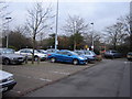
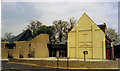
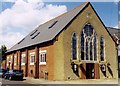
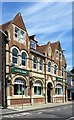
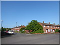
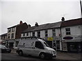
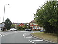
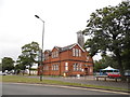
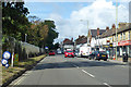
Photos of GU14 6HG


Area Information
GU14 6HG is a compact residential area in England, covering 1086 m² and home to 1954 residents. Its high population density of 1478 people per km² reflects a tightly knit community, though the area remains small enough to feel intimate. The postcode is a mix of younger and middle-aged residents, with a median age of 22 but the most common age group being adults aged 30–64. This suggests a balance between families and professionals. Daily life here is shaped by proximity to amenities, including five retail outlets, three rail stations, and two airports, making it convenient for commuters and those who work remotely. The area’s low crime risk score of 80 and no flood or environmental constraints add to its appeal. While home ownership is low at 17%, the presence of houses rather than flats indicates a focus on traditional housing stock. Living in GU14 6HG offers a blend of accessibility and safety, with the added benefit of being near Farnborough and Ash Vale, which provide further connectivity.
- Area Type
- Postcode
- Area Size
- 1086 m²
- Population
- 1954
- Population Density
- 1478 people/km²
The property market in GU14 6HG is dominated by rental properties, with only 17% of homes owned by residents. This suggests a strong presence of private landlords or housing associations, which is typical in areas with high population density. The accommodation type is exclusively houses, not flats, which is noteworthy given the compact nature of the postcode. This could mean that properties are larger or more spread out than typical for such a small area. For buyers, this dynamic implies limited availability of owner-occupied homes, potentially making the market competitive for those seeking to purchase. The focus on houses may also mean that the surrounding areas are similarly structured, offering a consistent housing stock. However, the low home ownership rate might indicate challenges for long-term investment, though the area’s safety and connectivity could offset this.
House Prices in GU14 6HG
Showing 1 properties
| Address | Type | Beds | Baths | Last Sale Price | Last Sale Date | |
|---|---|---|---|---|---|---|
| First Floor, 145 Lynchford Road, Farnborough, GU14 6HG | Flat | - | - | - | - |
Energy Efficiency in GU14 6HG
Living in GU14 6HG offers access to a range of amenities within practical reach. Retail options include Budgens 7Am, Aidan’s, Co-op Farnborough, and Waitrose Little, providing everyday shopping needs. The area’s rail stations—North Camp, Ash Vale, and Farnborough—connect residents to broader networks, while nearby airports cater to travel requirements. Though the data does not mention parks or leisure facilities, the proximity to multiple transport hubs and retail outlets suggests a lifestyle that prioritises convenience and accessibility. The compact nature of the area means that amenities are close, reducing the need for long commutes. This blend of retail, transport, and connectivity creates a practical environment for daily living, with a focus on efficiency and ease of access.
Amenities
Schools
The nearest school to GU14 6HG is Marlborough Infant School, a primary institution with a ‘good’ Ofsted rating. This provides a reliable option for families with young children, though the absence of secondary schools in the data suggests that parents may need to look beyond the immediate area for older children’s education. The presence of a well-rated primary school is a key draw for families, as it ensures quality early education without long commutes. Given the area’s focus on houses, it is possible that the school serves a larger local catchment area, including nearby postcodes. While the data does not mention other schools, the single listed institution highlights the need for prospective residents to consider secondary education options when planning their move.
| Rank | School | Type | Entry gender | Ages |
|---|
Explore more schools in this area
Go to Schools tabDemographics
The community in GU14 6HG is predominantly composed of adults aged 30–64, despite a median age of 22. This suggests a mix of younger individuals and older professionals, possibly linked to nearby employment hubs. Home ownership is exceptionally low at 17%, meaning most residents are renters, which may indicate a transient population or a focus on rental properties. The area’s accommodation is primarily houses, not flats, which is unusual for a high-density postcode. The predominant ethnic group is White, though no data on diversity or deprivation is provided. The population density of 1478 people per km² is among the highest in England, which could influence the character of the area, creating a more densely populated, possibly urban feel despite its small size. This density, combined with the low home ownership rate, may contribute to a community that is both active and interconnected.
Household Size
Accommodation Type
Tenure
Ethnic Group
Religion
Household Composition
Age
Household Deprivation
NS-SEC
Explore more demographic insights in this area
Go to Demographics tabPlanning
Planning Constraints
- Flood RiskPremium
- Ramsar Wetland SitesPremium
- Area of Outstanding Natural BeautyPremium
- Protected Nature ReservePremium
- Protected WoodlandPremium