Area Overview for GU14 6DG
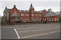
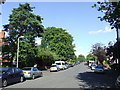
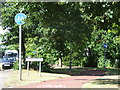
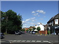
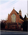
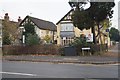
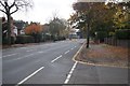
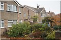
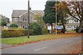
Photos of GU14 6DG
Area Information
GU14 6DG is a small, tightly packed residential postcode area in England, covering just 1,216 square metres and home to 1,440 residents. Its compact size means it is a highly concentrated community, with a population density of 1,184,144 people per square kilometre — a stark reflection of its limited space. This area is defined by its residential character, with a median age of 47 and a majority of residents aged between 30 and 64. Daily life here is likely shaped by the proximity of nearby amenities and the relatively low levels of risk associated with safety and environmental factors. The area’s small footprint means it is well-suited for those seeking a close-knit community, though its size also means it is not ideal for those needing extensive space. With a mix of owner-occupied homes and a population skewed towards adults, GU14 6DG appears to be a mature, stable neighbourhood. Its proximity to rail stations and airports suggests it may appeal to commuters or those with flexible work arrangements.
- Area Type
- Postcode
- Area Size
- 1216 m²
- Population
- 1440
- Population Density
- 5807 people/km²
The property market in GU14 6DG is characterised by a 53% home ownership rate, indicating that just over half of the properties are owner-occupied, while the remaining 47% are likely rented. The accommodation type is predominantly houses, which suggests a lack of high-rise or multi-unit developments. This makes the area appealing to buyers seeking traditional, standalone homes rather than flats or apartments. Given the postcode’s small size, the housing stock is limited, which may result in a competitive market for available properties. The high population density — 1,184,144 people per square kilometre — further underscores the scarcity of land, potentially driving up prices for available homes. For buyers, this means the area is not suited to those seeking large plots or new builds, but it may offer a sense of security in a stable, low-risk environment.
House Prices in GU14 6DG
No properties found in this postcode.
Energy Efficiency in GU14 6DG
The lifestyle in GU14 6DG is shaped by its proximity to retail, transport, and aviation hubs. Nearby shops include Co-op Farnborough, Budgens 7Am / Aidan’s, and Waitrose Little, offering a range of grocery and convenience options. The area’s rail stations — North Camp, Farnborough, and Ash Vale — provide easy access to broader regional networks, while Farnborough and Blackbushe Airports cater to those requiring air travel. These amenities suggest a practical, commuter-friendly lifestyle, with residents able to access both local services and regional connectivity. The mix of retail and transport infrastructure implies a balance between convenience and accessibility, though the small area size may limit the variety of leisure or recreational options.
Amenities
Schools
GU14 6DG is near two independent schools: Rushmoor Independent Preparatory School and Rushmoor Independent Grammar School. Both are private institutions, which may be of interest to families seeking non-state education. Independent schools often offer smaller class sizes, specialist curricula, and strong extracurricular programmes, though they typically require tuition fees. The presence of two such schools in proximity suggests a concentration of families prioritising private education. However, no data on Ofsted ratings or academic performance is available. For buyers, the availability of independent schools may be a key consideration, though it is important to verify whether these institutions align with specific educational preferences or budgets.
| Rank | School | Type | Entry gender | Ages |
|---|
Explore more schools in this area
Go to Schools tabDemographics
The population of GU14 6DG is predominantly adults, with 30–64-year-olds making up the largest age group. The median age of 47 indicates a mature demographic, which aligns with the area’s focus on owner-occupied housing, where 53% of residents are homeowners. The accommodation type is primarily houses, suggesting a lack of high-density housing or flats. The predominant ethnic group is White, though no specific data on diversity or deprivation levels is provided. The high population density — 1,184,144 people per square kilometre — implies that the area is intensely residential, with limited space for expansion. This density may influence the character of daily life, fostering a sense of community but potentially limiting green spaces or recreational areas. For buyers, the demographic profile suggests a stable, low-turnover market, with demand likely driven by existing residents seeking to remain in the area.
Household Size
Accommodation Type
Tenure
Ethnic Group
Religion
Household Composition
Age
Household Deprivation
NS-SEC
Explore more demographic insights in this area
Go to Demographics tabPlanning
Planning Constraints
- Flood RiskPremium
- Ramsar Wetland SitesPremium
- Area of Outstanding Natural BeautyPremium
- Protected Nature ReservePremium
- Protected WoodlandPremium