Area Overview for GU14 6BJ
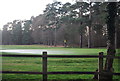
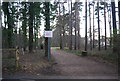
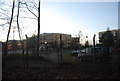
Photos of GU14 6BJ


Area Information
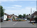
GU14 6BJ is a small residential cluster in England, covering just 2.1 hectares and home to 2,776 residents. With a population density of 391 people per square kilometre, it’s a compact area where daily life is shaped by its proximity to amenities. The postcode’s compact size means residents are within easy reach of retail, transport, and educational facilities. The community here skews older, with a median age of 47, and a majority of residents aged between 30 and 64. This suggests a stable, established population, likely drawn to the area for its practicality and accessibility. Living in GU14 6BJ means being close to rail networks, including North Camp and Aldershot stations, and within reach of two airports. The area’s broadband score of 99 ensures reliable internet connectivity, while its moderate crime risk score of 49 means residents should take standard precautions. For those seeking a quiet, functional neighbourhood with a mix of housing and nearby services, this postcode offers a straightforward, no-frills lifestyle.
- Area Type
- Postcode
- Area Size
- 2.1 hectares
- Population
- 2776
- Population Density
- 391 people/km²
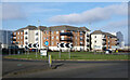
The property market in GU14 6BJ is characterised by a 57% home ownership rate, suggesting a balance between owner-occupied homes and rental properties. The area is dominated by houses rather than flats, which aligns with its residential, family-oriented appeal. This makes it a viable option for buyers seeking traditional housing stock in a small, established community. The compact size of the postcode means the housing stock is limited, so buyers should consider nearby areas for broader options. The presence of rail stations within practical reach, such as North Camp and Aldershot, adds to the area’s accessibility, potentially attracting commuters. However, with only 2.1 hectares of space, the market is unlikely to offer a wide range of property types. For those prioritising stability and proximity to services, the existing housing mix provides a straightforward, if modest, selection.
House Prices in GU14 6BJ
No properties found in this postcode.
Energy Efficiency in GU14 6BJ
Living in GU14 6BJ offers access to a range of nearby amenities, including five retail outlets such as Waitrose, Budgens, and Co-op. These shops provide convenience for daily shopping, though the area lacks larger supermarkets or specialised stores. The proximity to Farnborough and Blackbushe airports adds to the region’s connectivity, though these are primarily for travel rather than leisure. Rail stations like North Camp and Aldershot offer links to broader networks, supporting both commuting and exploration. While the data does not mention parks or leisure facilities, the compact layout suggests a focus on practicality over expansive recreational spaces. The availability of essential retail and transport options makes daily life in GU14 6BJ efficient, if somewhat utilitarian.
Amenities
Schools
The nearest school to GU14 6BJ is The Wavell School, a primary institution with a good Ofsted rating. This provides families with a reliable option for early education, though no secondary schools are listed in the data. The presence of a primary school with a positive rating suggests the area is suitable for families with young children, but those requiring secondary education may need to look beyond the immediate vicinity. The single school listed indicates a limited range of educational choices, which could be a consideration for households planning long-term stays. The absence of additional schools or information about their quality means buyers should investigate further if school options are a priority.
| Rank | School | Type | Entry gender | Ages |
|---|
Explore more schools in this area
Go to Schools tabDemographics
The community in GU14 6BJ is predominantly composed of adults aged 30 to 64, with a median age of 47. This suggests a mature, stable population, likely with long-term ties to the area. Home ownership rates stand at 57%, indicating a mix of owner-occupied properties and rental units. The accommodation type is primarily houses, reflecting a residential character that prioritises private living spaces over flats. The predominant ethnic group is White, and no specific data on diversity or deprivation is provided, so the community’s composition remains largely homogeneous. With 2,776 residents spread across 2.1 hectares, the area is densely populated for its size, which may influence local amenities and social dynamics. The demographic profile hints at a population that values stability and proximity to essential services, such as schools and transport links.
Household Size
Accommodation Type
Tenure
Ethnic Group
Religion
Household Composition
Age
Household Deprivation
NS-SEC
Explore more demographic insights in this area
Go to Demographics tabPlanning
Planning Constraints
- Flood RiskPremium
- Ramsar Wetland SitesPremium
- Area of Outstanding Natural BeautyPremium
- Protected Nature ReservePremium
- Protected WoodlandPremium