Area Overview for GU14 0PS
Photos of GU14 0PS

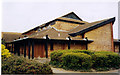
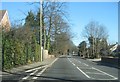
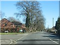
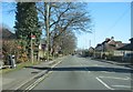
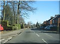
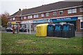

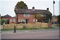
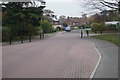
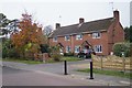
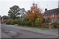
56 photos from this area
Area Information
Key information about the GU14 0PS including its size, population, and administrative classification.
- Area Type
- Postcode
- Area Size
- 1.0 hectares
- Population
- 1295
- Population Density
- 1246 people/km²
House Prices in GU14 0PS
24
Properties
£380,675
Average Sold Price
£249,950
Lowest Price
£550,000
Highest Price
Showing 24 properties
| Address | Type | Beds | Baths | Last Sale Price | Last Sale Date | |
|---|---|---|---|---|---|---|
| 20 Whitebeam Gardens, Farnborough, GU14 0PS | Detached | 4 | 1 | £550,000 | Nov 2025 | |
| 8 Whitebeam Gardens, Farnborough, GU14 0PS | Semi-detached | 3 | 2 | £435,000 | Aug 2025 | |
| 7 Whitebeam Gardens, Farnborough, GU14 0PS | Detached | 4 | 2 | £550,000 | Jul 2023 | |
| 4 Whitebeam Gardens, Farnborough, GU14 0PS | house | 3 | 1 | £435,000 | Aug 2022 | |
| 5 Whitebeam Gardens, Farnborough, GU14 0PS | Semi-detached | 3 | 1 | £390,000 | Sep 2021 | |
| 12 Whitebeam Gardens, Farnborough, GU14 0PS | house | - | - | £417,000 | Mar 2021 | |
| The Hythe, 19 Whitebeam Gardens, Farnborough, GU14 0PS | house | - | - | £525,000 | Jan 2021 | |
| 17 Whitebeam Gardens, Farnborough, GU14 0PS | house | 3 | - | £300,000 | Jun 2014 | |
| 22 Whitebeam Gardens, Farnborough, GU14 0PS | Detached | 4 | 2 | £347,500 | Nov 2013 | |
| 23 Whitebeam Gardens, Farnborough, GU14 0PS | house | - | - | £295,000 | Jun 2013 |
Page 1 of 3
Energy Efficiency in GU14 0PS
Amenities
Schools
| Rank | School | Type | Entry gender | Ages |
|---|
Explore more schools in this area
Go to Schools tabDemographics
Household Size
Two person
most common
Accommodation Type
Houses
most common
Tenure
87
majority
Ethnic Group
White
most common
Religion
N/A
most common
Household Composition
N/A
most common
Age
47
median
Adults (30-64 years)
most common
Household Deprivation
N/A
with no deprivation
NS-SEC
45
in Lower managerial occupations
Explore more demographic insights in this area
Go to Demographics tabPlanning
Planning Constraints
- Flood RiskPremium
- Ramsar Wetland SitesPremium
- Area of Outstanding Natural BeautyPremium
- Protected Nature ReservePremium
- Protected WoodlandPremium