Area Overview for GU14 0LG
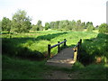
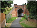
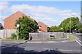
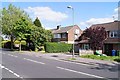
Photos of GU14 0LG


Area Information
Living in GU14 0LG offers a compact, tightly knit residential experience. This postcode area, spanning 1.7 hectares, is home to 1,326 residents, creating a densely populated yet intimate community. The area’s small size means it is likely a single, cohesive neighbourhood rather than a sprawling development. With a median age of 47 and a majority of residents aged 30–64, the area is dominated by mature adults, many of whom own their homes. Over 83% of properties are owner-occupied, reflecting a stable, long-term resident base. The high population density of 75,860 people per square kilometre suggests a mix of established housing and limited new development. Daily life here is likely characterised by proximity to amenities, with nearby retail, rail links, and airports within practical reach. The area’s compact nature means residents can access essential services without long commutes, though the small footprint may limit expansion or new construction. For those seeking a quiet, established community with strong local connections, GU14 0LG provides a distinct alternative to larger urban areas.
- Area Type
- Postcode
- Area Size
- 1.7 hectares
- Population
- 1326
- Population Density
- 3336 people/km²
The property market in GU14 0LG is dominated by owner-occupied homes, with 83% of properties in private hands. This high rate of home ownership suggests a stable, long-term resident base rather than a rental market. The accommodation type is primarily houses, indicating a lack of high-rise or apartment blocks. This housing stock is likely to appeal to families or individuals seeking traditional, spacious properties. Given the area’s small size and high population density, the housing stock is probably limited, with little scope for new developments. Buyers should consider that the compact nature of GU14 0LG may mean competition for available properties, particularly in desirable locations. The high home ownership rate also implies strong local demand, which could support property values. However, the area’s size and existing housing stock may restrict options for those seeking larger or newer properties.
House Prices in GU14 0LG
Showing 16 properties
| Address | Type | Beds | Baths | Last Sale Price | Last Sale Date | |
|---|---|---|---|---|---|---|
| 1 Thirlmere Close, Farnborough, GU14 0LG | Detached | 3 | 1 | £430,000 | Sep 2025 | |
| 3 Thirlmere Close, Farnborough, GU14 0LG | Semi-detached | 3 | 1 | £375,000 | Aug 2018 | |
| 6 Thirlmere Close, Farnborough, GU14 0LG | Retail | 4 | 2 | £370,000 | Nov 2015 | |
| 10A Thirlmere Close, Farnborough, GU14 0LG | Bungalow | 3 | 2 | £400,000 | Jan 2013 | |
| 14 Thirlmere Close, Farnborough, GU14 0LG | house | 3 | - | £262,500 | Aug 2010 | |
| 8 Thirlmere Close, Farnborough, GU14 0LG | Semi-detached | - | - | £269,995 | Sep 2007 | |
| 16 Thirlmere Close, Farnborough, GU14 0LG | Semi-detached | - | - | £205,000 | Mar 2003 | |
| 12 Thirlmere Close, Farnborough, GU14 0LG | house | - | - | £182,500 | Dec 2000 | |
| 18 Thirlmere Close, Farnborough, GU14 0LG | Detached | - | - | £127,500 | Sep 1998 | |
| 10 Thirlmere Close, Farnborough, GU14 0LG | Detached | - | - | £132,500 | Sep 1998 |
Energy Efficiency in GU14 0LG
Residents of GU14 0LG have access to a range of nearby amenities within practical reach. Retail options include major stores such as Tesco Farnborough, Morrisons Rafborough, and Costco Farnborough, ensuring convenience for shopping and daily needs. The area’s rail network, with stations like Farnborough Railway Station and Frimley Railway Station, provides easy access to commuting routes and regional connections. Nearby airports, including Farnborough Airport and Blackbushe Airport, offer additional travel flexibility. While the area’s small size limits extensive leisure facilities, the proximity to retail and transport hubs suggests a lifestyle focused on accessibility and practicality. The presence of multiple retail and transport options supports a convenient, efficient daily routine, though residents may need to travel further for specialist amenities or green spaces.
Amenities
Schools
| Rank | School | Type | Entry gender | Ages |
|---|
Explore more schools in this area
Go to Schools tabDemographics
The community in GU14 0LG is predominantly composed of adults aged 30–64, with a median age of 47. This suggests a mature, settled population, likely with established careers and family ties. Over 83% of residents own their homes, a figure significantly higher than the national average, indicating a preference for long-term residency over rental properties. The area is characterised by houses rather than flats, reflecting a traditional housing stock. The predominant ethnic group is White, though no specific data on diversity or deprivation levels is provided. The high population density of 75,860 people per square kilometre, combined with the small area size, implies a tightly packed residential environment. This density may influence local infrastructure, with limited space for new developments or public amenities. For buyers, this demographic profile suggests a neighbourhood with low turnover, stable property values, and a focus on long-term occupancy rather than transient populations.
Household Size
Accommodation Type
Tenure
Ethnic Group
Religion
Household Composition
Age
Household Deprivation
NS-SEC
Explore more demographic insights in this area
Go to Demographics tabPlanning
Planning Constraints
- Flood RiskPremium
- Ramsar Wetland SitesPremium
- Area of Outstanding Natural BeautyPremium
- Protected Nature ReservePremium
- Protected WoodlandPremium