Area Overview for GU14 0JY
Photos of GU14 0JY
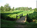
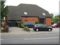
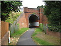
68 photos from this area
Area Information
Key information about the GU14 0JY including its size, population, and administrative classification.
- Area Type
- Postcode
- Area Size
- 6883 m²
- Population
- 1326
- Population Density
- 3336 people/km²
House Prices in GU14 0JY
21
Properties
£285,800
Average Sold Price
£95,950
Lowest Price
£408,000
Highest Price
Showing 21 properties
| Address | Type | Beds | Baths | Last Sale Price | Last Sale Date | |
|---|---|---|---|---|---|---|
| 20 Ambleside Close, Farnborough, GU14 0JY | Terraced | 3 | 1 | £408,000 | Jun 2024 | |
| 18 Ambleside Close, Farnborough, GU14 0JY | Terraced | 3 | - | £375,000 | Mar 2023 | |
| 14 Ambleside Close, Farnborough, GU14 0JY | Terraced | 3 | 1 | £362,000 | Jul 2022 | |
| 4 Ambleside Close, Farnborough, GU14 0JY | Terraced | 2 | 1 | £318,500 | Feb 2021 | |
| 3 Ambleside Close, Farnborough, GU14 0JY | house | - | - | £360,000 | Jan 2021 | |
| 6 Ambleside Close, Farnborough, GU14 0JY | Terraced | 4 | 2 | £347,500 | Jan 2018 | |
| 26 Ambleside Close, Farnborough, GU14 0JY | Semi-detached | 4 | - | £379,950 | Dec 2016 | |
| 7 Ambleside Close, Farnborough, GU14 0JY | Semi-detached | 3 | 1 | £310,000 | Jul 2015 | |
| 2 Ambleside Close, Farnborough, GU14 0JY | house | - | - | £230,000 | Oct 2013 | |
| 28 Ambleside Close, Farnborough, GU14 0JY | Semi-detached | - | - | £229,000 | Jul 2010 |
Page 1 of 3
Energy Efficiency in GU14 0JY
Amenities
Schools
| Rank | School | Type | Entry gender | Ages |
|---|
Explore more schools in this area
Go to Schools tabDemographics
Household Size
Two person
most common
Accommodation Type
Houses
most common
Tenure
83
majority
Ethnic Group
White
most common
Religion
N/A
most common
Household Composition
N/A
most common
Age
47
median
Adults (30-64 years)
most common
Household Deprivation
N/A
with no deprivation
NS-SEC
38
in Lower managerial occupations
Explore more demographic insights in this area
Go to Demographics tabPlanning
Planning Constraints
- Flood RiskPremium
- Ramsar Wetland SitesPremium
- Area of Outstanding Natural BeautyPremium
- Protected Nature ReservePremium
- Protected WoodlandPremium