Area Overview for GU14 0FB
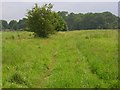
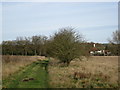
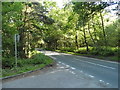
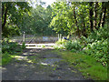
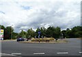
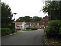
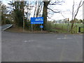
Photos of GU14 0FB


Area Information
GU14 0FB is a small, tightly packed residential area in England, covering just 3.7 hectares. With a population of 1295 people, it is a compact community where density is high at 1246 people per square kilometre. The area is defined by its cluster of homes, predominantly owner-occupied properties, reflecting a mature demographic. Residents here are largely adults aged 30–64, with a median age of 47. This suggests a stable, family-oriented environment where most households are long-term residents. Daily life is shaped by proximity to essential services and transport links, though the area’s small size means it is best suited for those prioritising convenience over sprawling landscapes. The absence of major planning constraints or environmental risks makes it a practical choice for buyers seeking a low-maintenance, safe neighbourhood. Its compact nature ensures that amenities and schools are within easy reach, though the area’s character is defined more by its residential density than by grandeur or architectural diversity.
- Area Type
- Postcode
- Area Size
- 3.7 hectares
- Population
- 1295
- Population Density
- 1246 people/km²
The property market in GU14 0FB is dominated by owner-occupied homes, with 87% of residents living in their own properties. This high rate of home ownership suggests a stable, long-term community with little turnover. The area’s accommodation type is exclusively houses, which is atypical for a small postcode area and may indicate a focus on family-friendly housing. Given the high population density of 1246 people per square kilometre, the housing stock is likely to be tightly packed, with limited scope for expansion. This makes the area more suitable for buyers seeking a compact, established home rather than a large property. The small size of the area also means that the immediate surroundings are crucial for buyers, with nearby amenities and transport links playing a significant role in property value. The absence of rental properties suggests a market that prioritises permanence over investment potential.
House Prices in GU14 0FB
Showing 1 properties
| Address | Type | Beds | Baths | Last Sale Price | Last Sale Date | |
|---|---|---|---|---|---|---|
| Alphabet House, Summit Avenue, Farnborough, GU14 0FB | Office | - | - | - | - |
Energy Efficiency in GU14 0FB
Living in GU14 0FB offers a blend of practicality and accessibility. The area is served by five retail outlets, including Waitrose Little Waitrose and Morrisons Rafborough, ensuring everyday shopping needs are met. Proximity to five railway stations, such as Fleet and Farnborough, provides easy access to regional transport, while two nearby airports—Farnborough and Blackbushe—cater to those requiring air travel. The compact nature of the area means amenities are within walking or short driving distance, though the lack of parks or leisure facilities is notable. The presence of multiple retail options and transport links contributes to a convenient lifestyle, though the area’s small size may limit opportunities for larger-scale leisure activities. For residents prioritising accessibility and proximity to services, GU14 0FB offers a functional, if unadorned, daily life.
Amenities
Schools
The nearest school to GU14 0FB is Southwood Infant School, a primary school with a good Ofsted rating. This indicates a reliable foundation for early education, though no secondary schools are listed in the data. The presence of a primary school with a strong rating is a key consideration for families, as it ensures quality education for younger children. However, the lack of secondary school options within the area may require families to look further afield for secondary education. The single school listed suggests a limited range of educational institutions, which could be a factor for parents prioritising a broad selection of schools. The good Ofsted rating provides reassurance about the standard of teaching and facilities, but buyers should consider the need for additional schooling options beyond primary level.
| Rank | School | Type | Entry gender | Ages |
|---|
Explore more schools in this area
Go to Schools tabDemographics
GU14 0FB is predominantly inhabited by adults aged 30–64, with a median age of 47. This suggests a community with a strong presence of middle-aged residents, likely including families and professionals. Home ownership is high at 87%, indicating a stable, long-term population rather than a transient rental market. The accommodation type is exclusively houses, which is unusual for a small postcode area and may reflect a preference for single-family living. The predominant ethnic group is White, with no data provided on other demographics. The population density of 1246 people per square kilometre is exceptionally high for a residential area, which may influence the character of local interactions and community cohesion. While no deprivation data is available, the high home ownership rate and absence of planning constraints suggest a relatively secure quality of life, though the area’s small size means it is not suited to those seeking expansive living spaces.
Household Size
Accommodation Type
Tenure
Ethnic Group
Religion
Household Composition
Age
Household Deprivation
NS-SEC
Explore more demographic insights in this area
Go to Demographics tabPlanning
Planning Constraints
- Flood RiskPremium
- Ramsar Wetland SitesPremium
- Area of Outstanding Natural BeautyPremium
- Protected Nature ReservePremium
- Protected WoodlandPremium