Area Overview for GU14 0ET
Photos of GU14 0ET
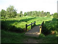
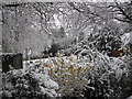
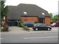
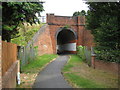
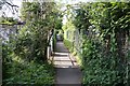
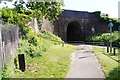
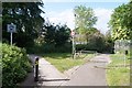
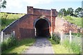
68 photos from this area
Area Information
Key information about the GU14 0ET including its size, population, and administrative classification.
- Area Type
- Postcode
- Area Size
- 2.1 hectares
- Population
- 1710
- Population Density
- 4340 people/km²
House Prices in GU14 0ET
47
Properties
£289,906
Average Sold Price
£79,000
Lowest Price
£490,000
Highest Price
Showing 47 properties
| Address | Type | Beds | Baths | Last Sale Price | Last Sale Date | |
|---|---|---|---|---|---|---|
| 18 Elmsleigh Road, Farnborough, GU14 0ET | Detached | 3 | 1 | £490,000 | Sep 2023 | |
| 31 Elmsleigh Road, Farnborough, GU14 0ET | Retail | 3 | 2 | £450,000 | Oct 2022 | |
| 16 Elmsleigh Road, Farnborough, GU14 0ET | house | - | - | £460,000 | Sep 2021 | |
| 8 Elmsleigh Road, Farnborough, GU14 0ET | house | - | - | £431,000 | Feb 2021 | |
| 29 Elmsleigh Road, Farnborough, GU14 0ET | house | - | - | £320,000 | Feb 2021 | |
| 38 Elmsleigh Road, Farnborough, GU14 0ET | Detached | 3 | 2 | £420,000 | May 2019 | |
| 35 Elmsleigh Road, Farnborough, GU14 0ET | Semi-detached | 3 | 1 | £375,000 | Mar 2018 | |
| 14 Elmsleigh Road, Farnborough, GU14 0ET | house | - | - | £300,000 | Oct 2015 | |
| 22 Elmsleigh Road, Farnborough, GU14 0ET | Detached | 3 | - | £367,500 | Nov 2013 | |
| 32 Elmsleigh Road, Farnborough, GU14 0ET | house | - | - | £260,000 | Apr 2013 |
Page 1 of 5
Energy Efficiency in GU14 0ET
Amenities
Schools
| Rank | School | Type | Entry gender | Ages |
|---|
Explore more schools in this area
Go to Schools tabDemographics
Household Size
Two person
most common
Accommodation Type
Houses
most common
Tenure
68
majority
Ethnic Group
White
most common
Religion
N/A
most common
Household Composition
N/A
most common
Age
47
median
Adults (30-64 years)
most common
Household Deprivation
N/A
with no deprivation
NS-SEC
41
in Lower managerial occupations
Explore more demographic insights in this area
Go to Demographics tabPlanning
Planning Constraints
- Flood RiskPremium
- Ramsar Wetland SitesPremium
- Area of Outstanding Natural BeautyPremium
- Protected Nature ReservePremium
- Protected WoodlandPremium