Area Overview for GU14 0DP
Photos of GU14 0DP
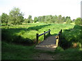
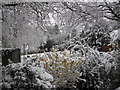
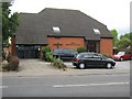
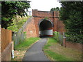
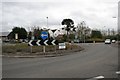
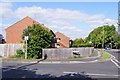
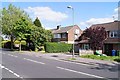
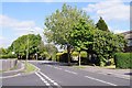
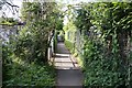
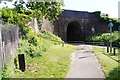
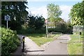
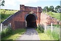
68 photos from this area
Area Information
Key information about the GU14 0DP including its size, population, and administrative classification.
- Area Type
- Postcode
- Area Size
- 5.5 hectares
- Population
- 1408
- Population Density
- 2164 people/km²
House Prices in GU14 0DP
40
Properties
£176,452
Average Sold Price
£55,000
Lowest Price
£367,500
Highest Price
Showing 40 properties
| Address | Type | Beds | Baths | Last Sale Price | Last Sale Date | |
|---|---|---|---|---|---|---|
| 73 Brookhouse Road, Farnborough, GU14 0DP | Terraced | 4 | 2 | £367,500 | Sep 2025 | |
| 7 Brookhouse Road, Farnborough, GU14 0DP | Terraced | 3 | 1 | £350,000 | Oct 2022 | |
| 3 Brookhouse Road, Farnborough, GU14 0DP | Terraced | 3 | 1 | £315,000 | Feb 2022 | |
| 25 Brookhouse Road, Farnborough, GU14 0DP | Terraced | 3 | 1 | £283,000 | Jul 2018 | |
| 61 Brookhouse Road, Farnborough, GU14 0DP | Terraced | 3 | - | £279,950 | Oct 2017 | |
| 21 Brookhouse Road, Farnborough, GU14 0DP | Terraced | 3 | 1 | £279,000 | May 2017 | |
| 49 Brookhouse Road, Farnborough, GU14 0DP | Semi-detached | 3 | 1 | £265,000 | Mar 2016 | |
| 9 Brookhouse Road, Farnborough, GU14 0DP | Terraced | 3 | 1 | £256,000 | Dec 2015 | |
| 27 Brookhouse Road, Farnborough, GU14 0DP | house | - | - | £220,000 | Jun 2015 | |
| 45 Brookhouse Road, Farnborough, GU14 0DP | Terraced | - | - | £208,000 | Oct 2014 |
Page 1 of 4
Energy Efficiency in GU14 0DP
Amenities
Schools
| Rank | School | Type | Entry gender | Ages |
|---|
Explore more schools in this area
Go to Schools tabDemographics
Household Size
Family (3-5 people)
most common
Accommodation Type
Houses
most common
Tenure
88
majority
Ethnic Group
White
most common
Religion
N/A
most common
Household Composition
N/A
most common
Age
47
median
Adults (30-64 years)
most common
Household Deprivation
N/A
with no deprivation
NS-SEC
50
in Lower managerial occupations
Explore more demographic insights in this area
Go to Demographics tabPlanning
Planning Constraints
- Flood RiskPremium
- Ramsar Wetland SitesPremium
- Area of Outstanding Natural BeautyPremium
- Protected Nature ReservePremium
- Protected WoodlandPremium