Area Overview for GU13 8PQ
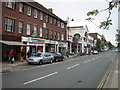
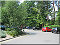
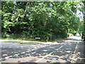
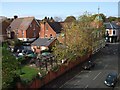
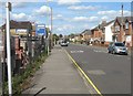
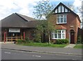
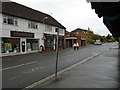
Photos of GU13 8PQ


Area Information
Living in GU13 8PQ means being part of a compact residential cluster in England, home to around 2,236 people. This small area is defined by its proximity to key transport links and retail hubs, making it a practical choice for those prioritising accessibility. The community here is predominantly middle-aged, with a median age of 47 and a strong presence of adults aged 30–64. Most residents own their homes, with flats forming the primary accommodation type. The area lacks significant natural or protected landscapes, but its strategic location near Fleet, Winchfield, and Farnborough ensures residents have multiple rail options and proximity to three airports. Daily life here balances suburban tranquillity with the convenience of nearby amenities, from supermarkets like Sainsburys and Waitrose to commuter rail stations. While the population is small, the area’s connectivity to larger towns and transport networks means it serves as a stepping stone for those working in nearby centres.
- Area Type
- Postcode
- Area Size
- Not available
- Population
- 2236
- Population Density
- 4996 people/km²
GU13 8PQ’s property market is characterised by a high proportion of owner-occupied homes, with 60% of residents owning their properties. The accommodation type is predominantly flats, which is typical for smaller residential clusters. This suggests a housing stock that is likely purpose-built or converted, catering to those seeking compact, low-maintenance living. The area’s small size means the immediate surroundings are critical for buyers seeking more options, as the local market may be limited in scope. For those considering purchase, the prevalence of flats could indicate a focus on affordability and ease of maintenance, though the lack of larger properties may appeal more to single occupants or couples. Given the area’s proximity to rail and airports, it may attract commuters or those prioritising transport links over expansive living spaces.
House Prices in GU13 8PQ
No properties found in this postcode.
Energy Efficiency in GU13 8PQ
Residents of GU13 8PQ have access to a range of amenities within practical reach. Retail options include major supermarkets such as Sainsburys Fleet, Morrisons Daily Fleet 229, and Waitrose Fleet, providing convenience for daily shopping. The area’s rail network, with stations like Fleet and Winchfield, offers easy access to nearby towns and cities, while proximity to Farnborough, Blackbushe, and RAF Odiham airports caters to travel needs. Though the data does not specify parks or leisure facilities, the presence of multiple retail and transport hubs suggests a lifestyle focused on practicality and connectivity. The area’s character is defined by its accessibility, with amenities designed to support both domestic and commuter lifestyles. For those valuing convenience over expansive recreational spaces, GU13 8PQ offers a straightforward, functional living experience.
Amenities
Schools
| Rank | School | Type | Entry gender | Ages |
|---|
Explore more schools in this area
Go to Schools tabDemographics
The population of GU13 8PQ is 2,236, with a median age of 47, indicating a mature demographic. The most common age range is adults aged 30–64, suggesting a stable community of working-age individuals and families. Home ownership is high at 60%, reflecting a mix of long-term residents and investors. The predominant accommodation type is flats, which aligns with the area’s compact nature. The majority of residents identify as White, with no specific data on other ethnic groups provided. This demographic profile implies a community focused on stability and practicality, with limited diversity in terms of age and ethnicity. The absence of detailed deprivation data means quality of life factors such as access to services or employment opportunities are not explicitly quantified, but the area’s amenities and transport links suggest a functional, if unremarkable, living environment.
Household Size
Accommodation Type
Tenure
Ethnic Group
Religion
Household Composition
Age
Household Deprivation
NS-SEC
Explore more demographic insights in this area
Go to Demographics tabPlanning
Planning Constraints
- Flood RiskPremium
- Ramsar Wetland SitesPremium
- Area of Outstanding Natural BeautyPremium
- Protected Nature ReservePremium
- Protected WoodlandPremium