Area Overview for GU12 6RJ
Photos of GU12 6RJ


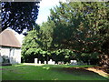
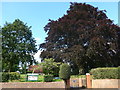


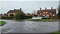

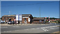
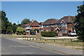
66 photos from this area
Area Information
Key information about the GU12 6RJ including its size, population, and administrative classification.
- Area Type
- Postcode
- Area Size
- 1.6 hectares
- Population
- 1498
- Population Density
- 3295 people/km²
House Prices in GU12 6RJ
26
Properties
£343,139
Average Sold Price
£139,950
Lowest Price
£715,000
Highest Price
Showing 26 properties
| Address | Type | Beds | Baths | Last Sale Price | Last Sale Date | |
|---|---|---|---|---|---|---|
| 1 Star Lane, Ash, GU12 6RJ | Detached | 3 | 2 | £635,000 | Feb 2024 | |
| 6 Star Lane, Ash, GU12 6RJ | Detached | - | - | £290,000 | Dec 2022 | |
| 23 Star Lane, Ash, GU12 6RJ | Detached | 4 | 2 | £715,000 | Nov 2022 | |
| 7 Star Lane, Ash, GU12 6RJ | house | 3 | 1 | £404,500 | May 2022 | |
| 10 Star Lane, Ash, GU12 6RJ | Retail | 3 | 2 | £515,000 | Feb 2022 | |
| 13 Star Lane, Ash, GU12 6RJ | Terraced | 3 | 2 | £415,000 | Jan 2021 | |
| 5 Star Lane, Ash, GU12 6RJ | Semi-detached | 3 | - | £272,500 | Feb 2018 | |
| 19 Star Lane, Ash, GU12 6RJ | Bungalow | 3 | 1 | £330,000 | Mar 2017 | |
| 22 Star Lane, Ash, GU12 6RJ | Semi-detached | 3 | 1 | £323,000 | Jan 2017 | |
| Medina, 9 Star Lane, Ash, GU12 6RJ | Bungalow | 4 | 1 | £487,500 | Jul 2016 |
Page 1 of 3
Energy Efficiency in GU12 6RJ
Amenities
Schools
| Rank | School | Type | Entry gender | Ages |
|---|
Explore more schools in this area
Go to Schools tabDemographics
Household Size
Family (3-5 people)
most common
Accommodation Type
Houses
most common
Tenure
61
majority
Ethnic Group
White
most common
Religion
N/A
most common
Household Composition
N/A
most common
Age
47
median
Adults (30-64 years)
most common
Household Deprivation
N/A
with no deprivation
NS-SEC
35
in Lower managerial occupations
Explore more demographic insights in this area
Go to Demographics tabPlanning
Planning Constraints
- Flood RiskPremium
- Ramsar Wetland SitesPremium
- Area of Outstanding Natural BeautyPremium
- Protected Nature ReservePremium
- Protected WoodlandPremium