Area Overview for GU12 6EU
Photos of GU12 6EU

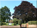
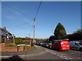
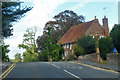
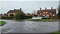
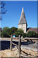
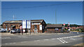
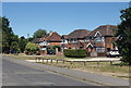
66 photos from this area
Area Information
Key information about the GU12 6EU including its size, population, and administrative classification.
- Area Type
- Postcode
- Area Size
- 5447 m²
- Population
- 1746
- Population Density
- 1107 people/km²
House Prices in GU12 6EU
11
Properties
£425,833
Average Sold Price
£250,000
Lowest Price
£545,000
Highest Price
Showing 11 properties
| Address | Type | Beds | Baths | Last Sale Price | Last Sale Date | |
|---|---|---|---|---|---|---|
| Newhaven, Grange Road, Ash, GU12 6EU | Retail | 2 | 1 | £460,000 | Aug 2022 | |
| Greenways, Grange Road, Ash, GU12 6EU | Semi-detached | 4 | 2 | £545,000 | Nov 2020 | |
| Ridley, Grange Road, Ash, GU12 6EU | Detached | 3 | 1 | £500,000 | Jun 2019 | |
| Springhaven, Grange Road, Ash, GU12 6EU | house | - | - | £350,000 | Dec 2012 | |
| The Dean, Grange Road, Ash, GU12 6EU | Detached | 3 | 1 | £250,000 | Jun 2011 | |
| Glenthorpe, Grange Road, Ash, GU12 6EU | house | - | - | £450,000 | Sep 2010 | |
| Brambly Hedge, Grange Road, Ash, GU12 6EU | Semi-detached | - | - | - | - | |
| Conifers, Grange Road, Ash, GU12 6EU | Semi-detached | - | - | - | - | |
| Roma, Grange Road, Ash, GU12 6EU | Semi-detached | - | - | - | - | |
| Grangefield, Grange Road, Ash, GU12 6EU | Semi-detached | - | - | - | - |
Page 1 of 2
Energy Efficiency in GU12 6EU
Amenities
Schools
| Rank | School | Type | Entry gender | Ages |
|---|
Explore more schools in this area
Go to Schools tabDemographics
Household Size
Two person
most common
Accommodation Type
Houses
most common
Tenure
90
majority
Ethnic Group
White
most common
Religion
N/A
most common
Household Composition
N/A
most common
Age
47
median
Adults (30-64 years)
most common
Household Deprivation
N/A
with no deprivation
NS-SEC
47
in Lower managerial occupations
Explore more demographic insights in this area
Go to Demographics tabPlanning
Planning Constraints
- Flood RiskPremium
- Ramsar Wetland SitesPremium
- Area of Outstanding Natural BeautyPremium
- Protected Nature ReservePremium
- Protected WoodlandPremium