Area Overview for GU12 6BX
Photos of GU12 6BX
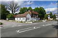
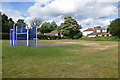
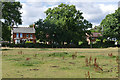
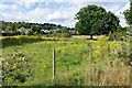
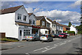
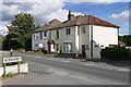
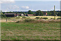
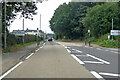
41 photos from this area
Area Information
Key information about the GU12 6BX including its size, population, and administrative classification.
- Area Type
- Postcode
- Area Size
- 4896 m²
- Population
- 1435
- Population Density
- 1786 people/km²
House Prices in GU12 6BX
11
Properties
£268,028
Average Sold Price
£106,250
Lowest Price
£505,000
Highest Price
Showing 11 properties
| Address | Type | Beds | Baths | Last Sale Price | Last Sale Date | |
|---|---|---|---|---|---|---|
| 7, Parsons Cottages, Harpers Road, Ash, GU12 6BX | Detached | 2 | 1 | £250,000 | Jun 2024 | |
| 2, Parsons Cottages, Harpers Road, Ash, GU12 6BX | Terraced | 2 | 2 | £370,000 | Oct 2022 | |
| Henridale, Harpers Road, Ash, GU12 6BX | Bungalow | 3 | 1 | £505,000 | Sep 2022 | |
| 8, Parsons Cottages, Harpers Road, Ash, GU12 6BX | Terraced | 2 | - | £320,000 | Apr 2018 | |
| 3, Parsons Cottages, Harpers Road, Ash, GU12 6BX | Terraced | 3 | 1 | £286,000 | Dec 2016 | |
| 6, Parsons Cottages, Harpers Road, Ash, GU12 6BX | Terraced | 2 | - | £222,000 | Jan 2014 | |
| 1, Parsons Cottages, Harpers Road, Ash, GU12 6BX | Terraced | - | - | £187,000 | Oct 2006 | |
| 4, Parsons Cottages, Harpers Road, Ash, GU12 6BX | Terraced | - | - | £166,000 | Dec 2004 | |
| Imanta, Harpers Road, Ash, GU12 6BX | Bungalow | 3 | 1 | £106,250 | Jun 1997 | |
| 5, Parsons Cottages, Harpers Road, Ash, GU12 6BX | Terraced | - | - | - | - |
Page 1 of 2
Energy Efficiency in GU12 6BX
Amenities
Schools
| Rank | School | Type | Entry gender | Ages |
|---|
Explore more schools in this area
Go to Schools tabDemographics
Household Size
Two person
most common
Accommodation Type
Houses
most common
Tenure
88
majority
Ethnic Group
White
most common
Religion
N/A
most common
Household Composition
N/A
most common
Age
47
median
Adults (30-64 years)
most common
Household Deprivation
N/A
with no deprivation
NS-SEC
40
in Lower managerial occupations
Explore more demographic insights in this area
Go to Demographics tabPlanning
Planning Constraints
- Flood RiskPremium
- Ramsar Wetland SitesPremium
- Area of Outstanding Natural BeautyPremium
- Protected Nature ReservePremium
- Protected WoodlandPremium