Area Overview for GU12 5LY
Photos of GU12 5LY
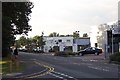
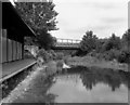
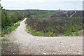
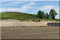
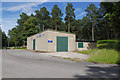
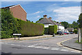
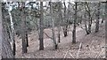
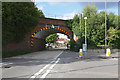
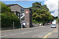
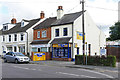
75 photos from this area
Area Information
Key information about the GU12 5LY including its size, population, and administrative classification.
- Area Type
- Postcode
- Area Size
- 7531 m²
- Population
- 1478
- Population Density
- 3893 people/km²
House Prices in GU12 5LY
28
Properties
£291,840
Average Sold Price
£123,000
Lowest Price
£429,995
Highest Price
Showing 28 properties
| Address | Type | Beds | Baths | Last Sale Price | Last Sale Date | |
|---|---|---|---|---|---|---|
| 29 Station Road East, Ash Vale, GU12 5LY | Detached | 4 | 3 | £382,000 | Jun 2018 | |
| 35 Station Road East, Ash Vale, GU12 5LY | Bungalow | 3 | 1 | £429,995 | Feb 2017 | |
| 65 Station Road East, Ash Vale, GU12 5LY | house | - | - | £249,950 | Jan 2017 | |
| 55 Station Road East, Ash Vale, GU12 5LY | house | 3 | - | £325,000 | Sep 2016 | |
| 41 Station Road East, Ash Vale, GU12 5LY | Detached | 3 | 1 | £400,000 | Aug 2016 | |
| 57 Station Road East, Ash Vale, GU12 5LY | Bungalow | 2 | 1 | £272,500 | Aug 2013 | |
| 63 Station Road East, Ash Vale, GU12 5LY | house | - | - | £242,000 | Dec 2012 | |
| Glenwood, 43 Station Road East, Ash Vale, GU12 5LY | Detached | 4 | 3 | £244,000 | Sep 2007 | |
| Brambles, 37 Station Road East, Ash Vale, GU12 5LY | Semi-detached | - | - | £249,950 | May 2007 | |
| 61 Station Road East, Ash Vale, GU12 5LY | Semi-detached | - | - | £123,000 | Oct 2000 |
Page 1 of 3
Energy Efficiency in GU12 5LY
Amenities
Schools
| Rank | School | Type | Entry gender | Ages |
|---|
Explore more schools in this area
Go to Schools tabDemographics
Household Size
Two person
most common
Accommodation Type
Houses
most common
Tenure
66
majority
Ethnic Group
White
most common
Religion
N/A
most common
Household Composition
N/A
most common
Age
47
median
Adults (30-64 years)
most common
Household Deprivation
N/A
with no deprivation
NS-SEC
44
in Lower managerial occupations
Explore more demographic insights in this area
Go to Demographics tabPlanning
Planning Constraints
- Flood RiskPremium
- Ramsar Wetland SitesPremium
- Area of Outstanding Natural BeautyPremium
- Protected Nature ReservePremium
- Protected WoodlandPremium