Area Overview for GU12 5HB
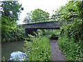
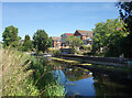
Photos of GU12 5HB


Area Information
GU12 5HB is a compact residential postcode in England, covering just 1,628 square metres and home to 1,435 residents. Its high population density of 881,553 people per square kilometre reflects a tightly knit community, though the area remains small enough to feel intimate. This is a place where houses dominate the housing stock, with 88% of residents owning their homes. The demographic profile suggests a mature population, with the median age at 47 and most residents falling within the 30-64 age range. Daily life here is shaped by proximity to essential services, including retail outlets and rail networks, while the area’s low crime risk and absence of environmental constraints make it a practical choice for families. The postcode’s limited size means amenities are concentrated, creating a self-contained environment where residents can access shops, schools, and transport links without needing to travel far. For those seeking a quiet, established neighbourhood with a focus on stability, GU12 5HB offers a blend of practicality and community cohesion.
- Area Type
- Postcode
- Area Size
- 1628 m²
- Population
- 1435
- Population Density
- 1786 people/km²
GU12 5HB is a predominantly owner-occupied area, with 88% of residents owning their homes. The housing stock is largely composed of houses, which is unusual for a small postcode but suggests a focus on single-family dwellings. This contrasts with areas where flats or apartments dominate, and it may indicate a market more suited to families or individuals seeking long-term stability. The limited size of the postcode means the property market is tightly concentrated, with little scope for large-scale development. For buyers, this creates a niche environment where properties are likely to be in established condition, though competition for available homes could be fierce. The absence of rental data means it is unclear whether the area also attracts tenants, but the high home ownership rate implies a strong local demand for residential property. Buyers should consider the proximity to rail links and schools as key selling points, given the area’s practical advantages for families.
House Prices in GU12 5HB
Showing 3 properties
| Address | Type | Beds | Baths | Last Sale Price | Last Sale Date | |
|---|---|---|---|---|---|---|
| 1, Fry's Acre, 3 College Road, Ash, GU12 5HB | Bungalow | 4 | - | - | - | |
| 2, Fry's Acre, 4 College Road, Ash, GU12 5HB | Detached | - | - | - | - | |
| Fry's Acre, College Road, Ash, GU12 5HB | Detached | - | - | - | - |
Energy Efficiency in GU12 5HB
The lifestyle in GU12 5HB is shaped by its proximity to essential amenities. Retail options include multiple Co-ops, such as Co-op Wharf, Co-op Ash, and Co-op Aldershot, providing convenience for everyday shopping. Rail stations like Ash Railway Station and North Camp Railway Station offer easy access to regional transport, while Farnborough Airport is a notable nearby facility for air travel. The area’s compact size means amenities are clustered, reducing the need for long journeys. Though the data does not mention parks or leisure facilities explicitly, the absence of environmental constraints like protected woodlands or AONB status suggests a practical, low-maintenance environment. The mix of retail, transport, and travel options creates a functional lifestyle, ideal for those prioritising accessibility over expansive leisure spaces.
Amenities
Schools
Residents of GU12 5HB have access to Shawfield Primary School, a state-funded primary school with a good Ofsted rating. This provides a reliable option for younger children, though the area lacks secondary schools, requiring families to travel to nearby towns for further education. The Bridge Tuition Centre, listed as an "other" educational institution, may offer supplementary learning or specialist support for students. The presence of a primary school with a strong rating is a significant advantage for families, reducing the need to commute for early education. However, the absence of secondary schools could be a limitation, particularly for parents seeking a full range of educational options within the area. Prospective buyers should assess the adequacy of local schools in relation to their children’s needs, factoring in travel time to secondary education.
| Rank | School | Type | Entry gender | Ages |
|---|
Explore more schools in this area
Go to Schools tabDemographics
The population of GU12 5HB is predominantly adults aged 30-64, with a median age of 47. This suggests a mature, settled community where homeownership is the norm, with 88% of residents owning their homes. The area is characterised by a high proportion of houses rather than flats, reflecting a preference for family-friendly housing. The predominant ethnic group is White, which aligns with broader regional trends. The age profile indicates a community with a strong presence of middle-aged and older residents, potentially influencing local services and amenities. With no data on deprivation levels, it is reasonable to infer that the area’s high home ownership and stable age distribution may correlate with a moderate quality of life, though further local insights would be needed to confirm this. The absence of younger demographics might also mean fewer schools catering to children under 5, though Shawfield Primary School serves the area effectively.
Household Size
Accommodation Type
Tenure
Ethnic Group
Religion
Household Composition
Age
Household Deprivation
NS-SEC
Explore more demographic insights in this area
Go to Demographics tabPlanning
Planning Constraints
- Flood RiskPremium
- Ramsar Wetland SitesPremium
- Area of Outstanding Natural BeautyPremium
- Protected Nature ReservePremium
- Protected WoodlandPremium