Area Overview for GU12 5ET
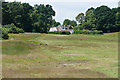
Photos of GU12 5ET


Area Information
GU12 5ET is a small, tightly knit residential postcode area in England, covering 5650 square metres and home to 1430 residents. With a population density of 886 people per square kilometre, it is a compact, community-focused neighbourhood where daily life is shaped by proximity to amenities and a strong local character. The area’s appeal lies in its balance of practicality and accessibility, with residents enjoying a mix of residential tranquillity and convenient access to nearby services. The median age of 47 suggests a mature, stable population, predominantly adults aged 30–64, many of whom are likely long-term residents. This demographic contributes to a sense of continuity, with homes mostly owner-occupied and the area’s housing stock focused on traditional houses. Living here means navigating a small but functional cluster of homes, where the pace of life is measured and the sense of neighbourhood is palpable. The area’s proximity to rail networks and retail hubs adds to its practicality, making it a viable choice for those seeking a settled, low-maintenance lifestyle without sacrificing connectivity.
- Area Type
- Postcode
- Area Size
- 5650 m²
- Population
- 1430
- Population Density
- 886 people/km²
The property market in GU12 5ET is characterised by high home ownership, with 86% of properties owner-occupied. This suggests a stable, long-term resident base with little reliance on rental housing. The area’s accommodation is predominantly houses, reflecting a preference for single-family homes over flats or apartments. Given the small size of the postcode area, the housing stock is limited, meaning buyers must consider the immediate surrounding areas for more options. The concentration of owner-occupied properties indicates a market where properties are likely to be held for the long term, potentially offering stability in value. However, the limited size of the area means that buyers should look beyond GU12 5ET itself to find additional properties, particularly if seeking specific features or larger homes. The focus on houses also implies that the area may appeal to those prioritising space and privacy over high-density living.
House Prices in GU12 5ET
Showing 6 properties
| Address | Type | Beds | Baths | Last Sale Price | Last Sale Date | |
|---|---|---|---|---|---|---|
| Sarum, Heathvale Bridge Road, Ash Vale, GU12 5ET | Bungalow | 3 | - | £509,000 | Apr 2017 | |
| Miramar, Heathvale Bridge Road, Ash Vale, GU12 5ET | Detached | 4 | - | £423,000 | Feb 2015 | |
| Heath Vale House, Heathvale Bridge Road, Ash Vale, GU12 5ET | Detached | - | - | £610,000 | Dec 2010 | |
| Haling Cottage, Heathvale Bridge Road, Ash Vale, GU12 5ET | Detached | - | - | £445,000 | Mar 2004 | |
| Canal Cottage, Heathvale Bridge Road, Ash Vale, GU12 5ET | Terraced | - | - | - | - | |
| Karibuni, Heathvale Bridge Road, Ash Vale, GU12 5ET | Detached | - | - | - | - |
Energy Efficiency in GU12 5ET
The lifestyle in GU12 5ET is shaped by its proximity to essential amenities, including five railway stations such as Ash Vale and North Camp, which provide regular commuter links. Nearby retail options include Tesco Ashvale, Co-op Wharf, and Budgens 7Am / Aidan’s, offering everyday shopping convenience. While the area lacks detailed information on parks or leisure facilities, the presence of multiple retail and transport hubs suggests a focus on practicality and accessibility. Residents can access a range of services within short distances, supporting a lifestyle that balances local convenience with broader connectivity. The character of the area is defined by its small-scale, community-oriented amenities, where daily needs are met without the need for long commutes. This makes GU12 5ET appealing to those who prioritise ease of access to shops, transport, and nearby airports.
Amenities
Schools
| Rank | School | Type | Entry gender | Ages |
|---|
Explore more schools in this area
Go to Schools tabDemographics
The community in GU12 5ET is defined by its mature demographic profile, with a median age of 47 and the majority of residents falling within the 30–64 age range. This suggests a population largely composed of working-age adults and older households, many of whom may be retired or in later careers. Home ownership is high, with 86% of properties owner-occupied, indicating a stable, long-term resident base. The accommodation is predominantly houses, reflecting a preference for single-family homes over flats or apartments. The predominant ethnic group is White, which aligns with broader trends in the region. The population density of 886 people per square kilometre means the area is neither sparse nor overcrowded, offering a balance between privacy and community interaction. This density, combined with the age profile, suggests a low turnover of residents and a focus on established, settled living. For prospective buyers, this demographic profile implies a neighbourhood with a strong sense of continuity and minimal pressure from transient populations.
Household Size
Accommodation Type
Tenure
Ethnic Group
Religion
Household Composition
Age
Household Deprivation
NS-SEC
Explore more demographic insights in this area
Go to Demographics tabPlanning
Planning Constraints
- Flood RiskPremium
- Ramsar Wetland SitesPremium
- Area of Outstanding Natural BeautyPremium
- Protected Nature ReservePremium
- Protected WoodlandPremium