Area Overview for GU12 5EG
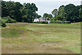
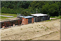
Photos of GU12 5EG


Area Information
GU12 5EG is a small, tightly knit residential postcode in England, covering 6,867 square metres and home to 1,430 people. With a population density of 886 people per square kilometre, it is a compact area where daily life is shaped by proximity to essential services and transport links. The area’s character is defined by its mix of older housing stock and practical living spaces, catering to a community predominantly composed of adults aged 30–64. Residents benefit from nearby rail connections, including Ash Vale and Ash railway stations, and a direct link to Farnborough Airport, making it convenient for commuters and those reliant on air travel. The area’s low flood risk and absence of protected natural sites suggest a stable environment, though standard security measures are advisable due to medium crime rates. Living in GU12 5EG offers a balance of accessibility and quietude, ideal for those seeking a manageable, well-connected residential setting without the pressures of larger urban centres.
- Area Type
- Postcode
- Area Size
- 6867 m²
- Population
- 1430
- Population Density
- 886 people/km²
The property market in GU12 5EG is dominated by owner-occupied homes, with 86% of residents owning their properties. This high rate of home ownership suggests a stable market where properties are likely to hold value over time. The area’s accommodation type is primarily houses, which are typically more spacious than flats and may appeal to families or those seeking larger living spaces. Given the small size of the postcode area, the housing stock is limited, meaning buyers may need to consider nearby areas for more options. The absence of rental properties indicates a community focused on long-term residency rather than transient populations. For buyers, this suggests a market where properties are likely to be in demand, though competition may be fierce due to the area’s constrained size.
House Prices in GU12 5EG
Showing 36 properties
| Address | Type | Beds | Baths | Last Sale Price | Last Sale Date | |
|---|---|---|---|---|---|---|
| 17 Elleray Court, Ash Vale, GU12 5EG | Flat | 2 | 1 | £275,000 | Oct 2025 | |
| 61 Elleray Court, Ash Vale, GU12 5EG | Flat | - | - | £150,000 | Jan 2025 | |
| 56 Elleray Court, Ash Vale, GU12 5EG | Flat | - | - | £247,500 | Oct 2024 | |
| 69 Elleray Court, Ash Vale, GU12 5EG | Flat | - | - | £242,000 | Aug 2023 | |
| 57 Elleray Court, Ash Vale, GU12 5EG | Flat | 2 | 1 | £235,000 | May 2023 | |
| 1 Elleray Court, Ash Vale, GU12 5EG | Flat | - | - | £234,000 | Apr 2023 | |
| 19 Elleray Court, Ash Vale, GU12 5EG | Flat | 2 | 1 | £252,000 | Oct 2022 | |
| 72 Elleray Court, Ash Vale, GU12 5EG | Flat | - | - | £250,000 | Aug 2022 | |
| 9 Elleray Court, Ash Vale, GU12 5EG | Flat | - | - | £225,000 | Feb 2022 | |
| 15 Elleray Court, Ash Vale, GU12 5EG | Flat | - | - | £225,000 | Nov 2021 |
Energy Efficiency in GU12 5EG
Living in GU12 5EG offers access to a range of nearby amenities, including five retail outlets such as Co-op Wharf, Tesco Ashvale, and Co-op Ash, ensuring everyday shopping needs are met. The area’s rail network, with stations like Ash Vale and North Camp, provides easy access to broader regional transport links. Farnborough Airport is a short distance away, offering travel options for both business and leisure. While the data does not specify parks or leisure facilities, the presence of multiple retail and transport hubs suggests a practical, convenience-focused lifestyle. Residents can enjoy a mix of local shopping, efficient commuting, and regional travel, making daily life in GU12 5EG both functional and accessible.
Amenities
Schools
| Rank | School | Type | Entry gender | Ages |
|---|
Explore more schools in this area
Go to Schools tabDemographics
The community in GU12 5EG is predominantly middle-aged, with a median age of 47 and the largest age group being adults aged 30–64. Home ownership is high, at 86%, indicating a stable, long-term resident base. The area is characterised by houses rather than flats, reflecting a preference for family-friendly or semi-detached living. The predominant ethnic group is White, and the population density of 886 people per square kilometre suggests a closely packed, communal feel. While no specific deprivation data is provided, the high home ownership rate and age profile imply a mature, established community with limited reliance on rental housing. This demographic profile suggests a neighbourhood where residents are likely to have established careers and family ties, contributing to a cohesive local environment.
Household Size
Accommodation Type
Tenure
Ethnic Group
Religion
Household Composition
Age
Household Deprivation
NS-SEC
Explore more demographic insights in this area
Go to Demographics tabPlanning
Planning Constraints
- Flood RiskPremium
- Ramsar Wetland SitesPremium
- Area of Outstanding Natural BeautyPremium
- Protected Nature ReservePremium
- Protected WoodlandPremium