Area Overview for GU12 5DJ
Photos of GU12 5DJ
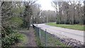
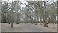
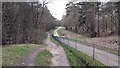
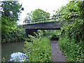
77 photos from this area
Area Information
Key information about the GU12 5DJ including its size, population, and administrative classification.
- Area Type
- Postcode
- Area Size
- 4178 m²
- Population
- 1430
- Population Density
- 886 people/km²
House Prices in GU12 5DJ
14
Properties
£264,136
Average Sold Price
£181,000
Lowest Price
£325,000
Highest Price
Showing 14 properties
| Address | Type | Beds | Baths | Last Sale Price | Last Sale Date | |
|---|---|---|---|---|---|---|
| 234 Shawfield Road, Ash, GU12 5DJ | Terraced | 2 | - | £315,000 | Nov 2020 | |
| 228 Shawfield Road, Ash, GU12 5DJ | Bungalow | 2 | 1 | £320,000 | May 2016 | |
| 238 Shawfield Road, Ash, GU12 5DJ | Semi-detached | 3 | - | £325,000 | Nov 2015 | |
| 230 Shawfield Road, Ash, GU12 5DJ | house | - | - | £293,000 | Aug 2010 | |
| 232 Shawfield Road, Ash, GU12 5DJ | Terraced | - | - | £214,950 | Nov 2006 | |
| 236 Shawfield Road, Ash, GU12 5DJ | Terraced | - | - | £200,000 | Jun 2006 | |
| 240 Shawfield Road, Ash, GU12 5DJ | house | - | - | £181,000 | May 2004 | |
| The Flat, 246 Shawfield Road, Ash, GU12 5DJ | Flat | 1 | 1 | - | - | |
| 244A Shawfield Road, Ash, GU12 5DJ | Bungalow | 3 | 1 | - | - | |
| First Floor Flat, 244A Shawfield Road, Ash, GU12 5DJ | Flat | - | - | - | - |
Page 1 of 2
Energy Efficiency in GU12 5DJ
Amenities
Schools
| Rank | School | Type | Entry gender | Ages |
|---|
Explore more schools in this area
Go to Schools tabDemographics
Household Size
Two person
most common
Accommodation Type
Houses
most common
Tenure
86
majority
Ethnic Group
White
most common
Religion
N/A
most common
Household Composition
N/A
most common
Age
47
median
Adults (30-64 years)
most common
Household Deprivation
N/A
with no deprivation
NS-SEC
47
in Lower managerial occupations
Explore more demographic insights in this area
Go to Demographics tabPlanning
Planning Constraints
- Flood RiskPremium
- Ramsar Wetland SitesPremium
- Area of Outstanding Natural BeautyPremium
- Protected Nature ReservePremium
- Protected WoodlandPremium