Area Overview for GU12 4PR
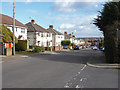
Photos of GU12 4PR


Area Information
GU12 4PR is a compact residential postcode in England, covering just 1.2 hectares and home to 1,315 people. Its high population density—105,214 people per square kilometre—reflects its role as a tightly knit, small-scale community. Nestled near Aldershot, this area offers a blend of practicality and proximity to essential services. Residents benefit from nearby amenities such as Sainsburys Aldershot and multiple railway stations, including Aldershot and Ash Vale, which connect to broader transport networks. The area’s broadband score of 100 ensures seamless digital connectivity, while mobile coverage scores at 83 provide reliable communication. Daily life here is shaped by its residential focus, with homes predominating over other property types. While the area lacks expansive green spaces, its strategic location near Farnborough Airport and rail links makes it appealing for commuters and those prioritising accessibility. The community’s age profile, skewed toward adults aged 30–64, suggests a stable, established demographic. For buyers, GU12 4PR offers a small, well-serviced cluster of homes with strong connectivity, though its limited size means proximity to nearby towns is key.
- Area Type
- Postcode
- Area Size
- 1.2 hectares
- Population
- 1315
- Population Density
- 8365 people/km²
GU12 4PR is primarily an owner-occupied area, with 73% of homes owned by residents rather than rented. The accommodation type is predominantly houses, which contrasts with areas where flats or apartments dominate. This suggests a housing stock suited to families or individuals seeking more space, though the area’s limited size—just 1.2 hectares—means the number of properties is constrained. Buyers should consider the compact nature of the area, which may require looking beyond GU12 4PR itself for larger properties or additional amenities. The high home ownership rate indicates a stable market, but the small postcode area means competition for available homes could be fierce. Proximity to Aldershot and Ash Vale railway stations adds value, offering easy access to commuting routes. For those prioritising space, nearby towns may provide better options, though GU12 4PR’s connectivity to rail and air travel makes it a practical choice for those needing swift access to transport networks.
House Prices in GU12 4PR
Showing 46 properties
| Address | Type | Beds | Baths | Last Sale Price | Last Sale Date | |
|---|---|---|---|---|---|---|
| 71 Haig Road, Aldershot, GU12 4PR | Terraced | 3 | - | £340,000 | Nov 2024 | |
| 68 Haig Road, Aldershot, GU12 4PR | Semi-detached | 3 | 1 | £272,500 | Jan 2024 | |
| 52 Haig Road, Aldershot, GU12 4PR | Semi-detached | 3 | 1 | £415,000 | Dec 2022 | |
| 43 Haig Road, Aldershot, GU12 4PR | house | - | - | £220,000 | Jun 2021 | |
| 54 Haig Road, Aldershot, GU12 4PR | house | - | - | £350,000 | Jan 2021 | |
| 73 Haig Road, Aldershot, GU12 4PR | Semi-detached | 3 | 1 | £284,000 | Nov 2018 | |
| 45 Haig Road, Aldershot, GU12 4PR | Terraced | 3 | - | £275,000 | Jul 2018 | |
| 56 Haig Road, Aldershot, GU12 4PR | house | 3 | - | £273,000 | Jun 2018 | |
| 47 Haig Road, Aldershot, GU12 4PR | Terraced | 3 | 1 | £289,950 | Mar 2018 | |
| 79 Haig Road, Aldershot, GU12 4PR | Terraced | 2 | - | £276,000 | Feb 2017 |
Energy Efficiency in GU12 4PR
Living in GU12 4PR means access to a range of essential retail and transport hubs within easy reach. The area is served by five retail outlets, including Sainsburys Aldershot and Co-op Aldershot, providing convenience for grocery shopping and daily errands. Rail connectivity is robust, with Aldershot, Ash, and Ash Vale stations offering links to regional and national routes. The proximity to Farnborough Airport adds another layer of accessibility, particularly for those needing regular air travel. While the data does not mention parks or leisure facilities, the presence of multiple retail and transport options suggests a practical, service-oriented lifestyle. The compact nature of the area means residents may rely on nearby towns for more extensive leisure opportunities, but the immediate vicinity offers sufficient amenities for daily needs. The combination of retail, rail, and air connectivity ensures a functional lifestyle, though those seeking expansive green spaces or cultural venues may need to look further afield.
Amenities
Schools
| Rank | School | Type | Entry gender | Ages |
|---|
Explore more schools in this area
Go to Schools tabDemographics
The population of GU12 4PR is predominantly adults aged 30–64, with a median age of 47. This suggests a mature, settled community with a focus on long-term residency. Home ownership is high at 73%, indicating a strong presence of owner-occupied properties, many of which are houses rather than flats or apartments. The predominant ethnic group is White, though the data does not specify further diversity. The area’s population density—over 100,000 people per square kilometre—means living spaces are closely packed, which may influence the character of daily interactions and local services. While the data does not quantify deprivation levels, the high home ownership rate and stable age profile suggest a relatively secure economic environment. However, the compact nature of the area may limit opportunities for expansion or new developments. Residents likely value the convenience of proximity to amenities, even if the area’s small size means it relies heavily on nearby towns for broader facilities.
Household Size
Accommodation Type
Tenure
Ethnic Group
Religion
Household Composition
Age
Household Deprivation
NS-SEC
Explore more demographic insights in this area
Go to Demographics tabPlanning
Planning Constraints
- Flood RiskPremium
- Ramsar Wetland SitesPremium
- Area of Outstanding Natural BeautyPremium
- Protected Nature ReservePremium
- Protected WoodlandPremium