Area Overview for GU12 4LG
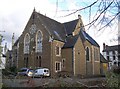
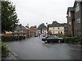
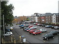
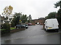
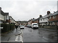
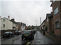
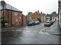
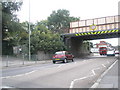
Photos of GU12 4LG
Area Information
GU12 4LG is a compact residential postcode in England, covering 4,356 square metres and home to 1,942 residents. Its high population density of 445,837 people per square kilometre reflects a tightly knit community, though the area remains small enough to maintain a sense of familiarity. The demographic profile shows a mature population, with a median age of 47 and the majority of residents aged 30–64. This suggests a stable, established community with strong family ties. The area’s housing stock is predominantly owner-occupied, with 65% of homes owned by residents, and most properties are houses rather than flats. Daily life in GU12 4LG is shaped by its proximity to key services and transport links, making it practical for commuters and families. While the area lacks sprawling green spaces or major landmarks, its compact size ensures that amenities and services are within easy reach, supporting a lifestyle that balances convenience with a quiet, residential character.
- Area Type
- Postcode
- Area Size
- 4356 m²
- Population
- 1942
- Population Density
- 7342 people/km²
GU12 4LG is characterised by a strong owner-occupied market, with 65% of homes owned by residents. This contrasts with areas where rental properties dominate, suggesting a community of long-term residents rather than transient tenants. The accommodation type is predominantly houses, which is unusual for a postcode of this size, indicating a focus on single-family homes. This housing stock may appeal to buyers seeking traditional, spacious properties in a compact setting. However, the limited area size means the market is small, and property availability could be constrained. For buyers, this means competition may be higher, but the owner-occupation rate suggests a stable market with potential for long-term value retention. The presence of houses rather than flats also implies a preference for private outdoor space, which may be a key consideration for prospective buyers.
House Prices in GU12 4LG
Showing 17 properties
| Address | Type | Beds | Baths | Last Sale Price | Last Sale Date | |
|---|---|---|---|---|---|---|
| 10 St Josephs Road, Aldershot, GU12 4LG | house | 3 | 1 | £385,000 | Nov 2021 | |
| Living Accommodation, 14 St Josephs Road, Aldershot, GU12 4LG | Flat | - | - | £390,000 | Jun 2021 | |
| 1 St Josephs Road, Aldershot, GU12 4LG | Detached | 3 | - | £310,000 | May 2015 | |
| 6 St Josephs Road, Aldershot, GU12 4LG | Semi-detached | 3 | - | £243,000 | Jan 2014 | |
| Sunnylea, 7 St Josephs Road, Aldershot, GU12 4LG | Semi-detached | - | - | £285,000 | Dec 2006 | |
| 1A St Josephs Road, Aldershot, GU12 4LG | Detached | 3 | 2 | £185,000 | May 2004 | |
| 2 St Josephs Road, Aldershot, GU12 4LG | Detached | 3 | 1 | £79,000 | Jan 1998 | |
| 8 St Josephs Road, Aldershot, GU12 4LG | Detached | 3 | 1 | - | - | |
| 12 St Josephs Road, Aldershot, GU12 4LG | Semi-detached | 3 | - | - | - | |
| Flat 5, 14 St Josephs Road, Aldershot, GU12 4LG | Flat | - | - | - | - |
Energy Efficiency in GU12 4LG
Living in GU12 4LG offers access to essential amenities within a short distance. The area’s proximity to five rail stations, including Aldershot and North Camp, ensures easy travel for commuting or leisure. Retail options such as Iceland Aldershot, Lidl Central, and Morrisons Aldershot provide a range of shopping needs, from groceries to household items. Farnborough Airport is a significant nearby facility, offering regional flight connections. While the data does not mention parks or leisure facilities, the presence of multiple retail and transport hubs suggests a practical, service-oriented lifestyle. The compact nature of the area means amenities are not sprawling but concentrated, allowing residents to access daily necessities without long journeys. This convenience, paired with strong transport links, makes GU12 4LG suitable for those prioritising accessibility over expansive recreational spaces.
Amenities
Schools
The nearest school to GU12 4LG is Stanley House School, an independent institution. Independent schools typically charge tuition fees and may offer specialised curricula or smaller class sizes, though the data does not include Ofsted ratings or academic performance details. The presence of a single school in the immediate vicinity suggests that families may need to travel beyond the postcode for additional educational options. For parents prioritising independent education, Stanley House School provides a direct choice, but the lack of state schools in the area could be a consideration for those seeking public education. The school’s type and location mean it caters to a specific demographic, likely aligned with the area’s mature population and home ownership profile.
| Rank | School | Type | Entry gender | Ages |
|---|
Explore more schools in this area
Go to Schools tabDemographics
The population of GU12 4LG is predominantly composed of adults aged 30–64, reflecting a mature, stable community. The median age of 47 indicates that the area is not heavily populated by young families or retirees, but rather by working-age individuals and older residents. Home ownership is high at 65%, with the majority of properties being houses rather than flats. This suggests a focus on family homes and long-term residency. The predominant ethnic group is White, though the data does not provide further breakdowns of diversity. The age profile and ownership rates imply a community that values stability and permanence. With a population density of 445,837 people per square kilometre, the area is densely populated, which may influence local services and social dynamics. However, the absence of specific deprivation data means the quality of life implications of this density remain unquantified.
Household Size
Accommodation Type
Tenure
Ethnic Group
Religion
Household Composition
Age
Household Deprivation
NS-SEC
Explore more demographic insights in this area
Go to Demographics tabPlanning
Planning Constraints
- Flood RiskPremium
- Ramsar Wetland SitesPremium
- Area of Outstanding Natural BeautyPremium
- Protected Nature ReservePremium
- Protected WoodlandPremium