Area Overview for GU12 4HG
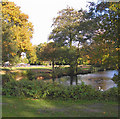
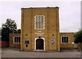
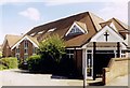
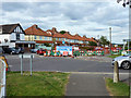
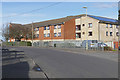
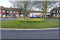
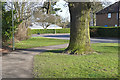
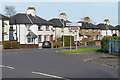
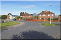
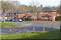
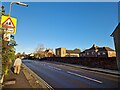
Photos of GU12 4HG

Area Information
Living in GU12 4HG means being part of a tightly knit residential cluster in England, where 1,575 people reside across 6,988 square metres. This small area, though densely populated at 225,389 people per square kilometre, retains a quiet, suburban character. The community is predominantly middle-aged, with a median age of 47 and most residents falling within the 30-64 age range. Home ownership is high at 79%, suggesting a stable, long-term presence. The area’s compact size means amenities and services are within easy reach, while its proximity to rail networks and a nearby airport offers flexibility for commuters. With no major environmental constraints or flood risks, GU12 4HG combines practicality with a low-stress lifestyle. For those seeking a balance between residential comfort and accessibility, this postcode offers a snapshot of a community where daily life is shaped by local shops, quiet streets, and reliable transport links.
- Area Type
- Postcode
- Area Size
- 6988 m²
- Population
- 1575
- Population Density
- 7687 people/km²
The property market in GU12 4HG is characterised by a high rate of home ownership, with 79% of properties owned by residents rather than rented. This suggests a community where long-term investment is common, and the housing stock is largely composed of houses. The prevalence of owner-occupied homes indicates a demand for stable, family-friendly properties, which may influence the availability of rental options in the area. Given the small size of the postcode and its focus on houses, the market is likely to be limited in scale, with properties primarily catering to local residents rather than commuters or investors. Buyers should consider the compact nature of the area, as expansion or new developments may be constrained by existing land use. The dominance of houses also implies a preference for private, low-density living, which may appeal to those seeking space and tranquillity.
House Prices in GU12 4HG
Showing 22 properties
| Address | Type | Beds | Baths | Last Sale Price | Last Sale Date | |
|---|---|---|---|---|---|---|
| 23 Brighton Road, Aldershot, GU12 4HG | house | - | - | £270,000 | Dec 2025 | |
| 9 Brighton Road, Aldershot, GU12 4HG | Terraced | 3 | 2 | £270,000 | Dec 2024 | |
| 13 Brighton Road, Aldershot, GU12 4HG | Bungalow | 2 | 1 | £322,000 | May 2023 | |
| 47 Brighton Road, Aldershot, GU12 4HG | Semi-detached | 3 | 1 | £435,000 | Apr 2023 | |
| 3 Brighton Road, Aldershot, GU12 4HG | Terraced | 1 | 3 | £310,000 | Jan 2023 | |
| 37 Brighton Road, Aldershot, GU12 4HG | Terraced | 3 | 2 | £350,000 | Oct 2022 | |
| 35 Brighton Road, Aldershot, GU12 4HG | Terraced | 2 | 1 | £310,000 | Jul 2022 | |
| 33 Brighton Road, Aldershot, GU12 4HG | house | 3 | 2 | £320,000 | Jun 2021 | |
| 1 Brighton Road, Aldershot, GU12 4HG | Terraced | 3 | 1 | £310,000 | Feb 2021 | |
| 11 Brighton Road, Aldershot, GU12 4HG | house | 3 | 2 | £375,000 | Jan 2021 |
Energy Efficiency in GU12 4HG
Daily life in GU12 4HG is shaped by its proximity to essential amenities. Local shops such as Sainsburys Aldershot, The Southern Co-operative Co, and Co-op Aldershot provide convenience for grocery shopping and everyday needs. The area’s rail network, with stations at Aldershot, Ash, and Ash Vale, connects residents to broader regional services, while Farnborough Airport offers direct access to national and international travel. These amenities contribute to a lifestyle that balances local convenience with wider connectivity. The compact nature of the area ensures that services are within walking or short driving distance, reducing the need for lengthy commutes. For residents, this means a blend of suburban tranquillity and practical accessibility, where daily errands and travel options are efficiently integrated into the community.
Amenities
Schools
| Rank | School | Type | Entry gender | Ages |
|---|
Explore more schools in this area
Go to Schools tabDemographics
The community in GU12 4HG is defined by its age profile and household composition. With a median age of 47, the area is primarily occupied by adults aged 30-64, reflecting a mature, established population. Home ownership is strong at 79%, indicating a high proportion of long-term residents rather than renters. The accommodation type is predominantly houses, which aligns with the area’s low population density and suburban layout. Ethnically, the majority of residents identify as White, though specific diversity metrics are not provided in the data. The high home ownership rate and age demographic suggest a community focused on stability and family-oriented living. The absence of significant deprivation data means quality of life appears to be supported by infrastructure and services, though further details on socioeconomic diversity are not available.
Household Size
Accommodation Type
Tenure
Ethnic Group
Religion
Household Composition
Age
Household Deprivation
NS-SEC
Explore more demographic insights in this area
Go to Demographics tabPlanning
Planning Constraints
- Flood RiskPremium
- Ramsar Wetland SitesPremium
- Area of Outstanding Natural BeautyPremium
- Protected Nature ReservePremium
- Protected WoodlandPremium