Area Overview for GU12 4EX
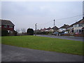
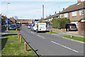
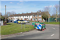
Photos of GU12 4EX


Area Information
GU12 4EX is a compact residential postcode in England, covering 5,141 square metres and home to 1,850 residents. Its high population density of 359,877 people per square kilometre reflects a tightly knit community, where proximity to amenities and services is a defining feature. The area is characterised by a mix of houses, with 60% of residents owning their homes. Daily life here is shaped by its small-scale nature, where local shops, rail links, and schools form the backbone of the neighbourhood. The postcode’s proximity to Aldershot and Farnborough ensures easy access to larger towns, while its own amenities, such as Sainsburys and multiple railway stations, cater to everyday needs. With a median age of 47 and a population skewed towards adults aged 30–64, the area feels established yet active, offering a blend of stability and convenience. The excellent broadband score of 100 underscores its appeal for those reliant on digital connectivity, though the high flood risk score requires careful consideration for prospective buyers.
- Area Type
- Postcode
- Area Size
- 5141 m²
- Population
- 1850
- Population Density
- 4787 people/km²
The property market in GU12 4EX is dominated by owner-occupied homes, with 60% of residents owning their properties. This suggests a stable market with a focus on long-term residency rather than short-term rental activity. The area’s housing stock is primarily composed of houses, which may appeal to families seeking more space than flats or apartments. Given the small size of the postcode and its high population density, the housing stock is likely limited, meaning buyers should consider the immediate surrounding areas for more options. The compact nature of GU12 4EX may also mean that property values are influenced by proximity to key amenities, such as the railway stations and schools. For buyers, this could translate to a competitive market where location and condition are critical factors.
House Prices in GU12 4EX
Showing 42 properties
| Address | Type | Beds | Baths | Last Sale Price | Last Sale Date | |
|---|---|---|---|---|---|---|
| 73 Aspen Grove, Aldershot, GU12 4EX | Flat | - | - | £175,000 | May 2024 | |
| 68 Aspen Grove, Aldershot, GU12 4EX | Flat | - | - | £200,000 | Sep 2023 | |
| 34 Aspen Grove, Aldershot, GU12 4EX | Flat | - | - | £182,000 | Aug 2023 | |
| 33 Aspen Grove, Aldershot, GU12 4EX | Flat | 2 | 1 | £195,000 | Sep 2021 | |
| 41 Aspen Grove, Aldershot, GU12 4EX | Flat | - | - | £160,000 | Jun 2021 | |
| 53 Aspen Grove, Aldershot, GU12 4EX | Flat | 2 | 1 | £188,000 | Nov 2020 | |
| 55 Aspen Grove, Aldershot, GU12 4EX | Flat | - | - | £166,000 | Feb 2020 | |
| 39 Aspen Grove, Aldershot, GU12 4EX | Flat | - | - | £160,000 | May 2019 | |
| 47 Aspen Grove, Aldershot, GU12 4EX | Flat | 2 | 1 | £178,000 | Apr 2019 | |
| 42 Aspen Grove, Aldershot, GU12 4EX | Flat | 2 | 1 | £170,000 | Dec 2018 |
Energy Efficiency in GU12 4EX
GU12 4EX offers a range of amenities within practical reach, enhancing the daily lives of its residents. The area is served by five retail outlets, including Sainsburys Aldershot and The Southern Co-operative, providing access to groceries, household goods, and other essentials. Multiple railway stations, such as Aldershot and Ash Vale, ensure easy travel to nearby towns and cities, while Farnborough Airport offers international connectivity. Though the data does not mention parks or leisure facilities, the presence of rail and retail options suggests a lifestyle focused on practicality and convenience. The compact nature of the area means that amenities are closely clustered, reducing the need for long commutes and fostering a sense of self-sufficiency.
Amenities
Schools
The nearest school to GU12 4EX is The Connaught School, a primary school serving the local community. While no Ofsted rating is provided, the presence of a primary school within practical reach is a significant factor for families with young children. The area’s small size means that this single school is likely the primary educational option for local residents, though the lack of secondary schools or additional educational institutions may require families to commute to nearby towns. The absence of data on other schools or their performance means that prospective buyers should investigate further to understand the full range of educational opportunities available.
| Rank | School | Type | Entry gender | Ages |
|---|
Explore more schools in this area
Go to Schools tabDemographics
GU12 4EX has a median age of 47, with the majority of residents falling within the 30–64 age range. This suggests a mature, settled community, likely with a strong presence of families and professionals. Home ownership is high, at 60%, and the area is predominantly composed of houses rather than flats or apartments. The predominant ethnic group is White, reflecting a homogenous demographic profile. The population density of 359,877 people per square kilometre is exceptionally high, which may influence the character of daily life, fostering a sense of closeness among residents. However, such density can also mean limited space for expansion or new developments. The absence of specific data on deprivation or diversity metrics means that while the area is clearly defined by its age and ownership patterns, broader socioeconomic factors remain unexplored in this context.
Household Size
Accommodation Type
Tenure
Ethnic Group
Religion
Household Composition
Age
Household Deprivation
NS-SEC
Explore more demographic insights in this area
Go to Demographics tabPlanning
Planning Constraints
- Flood RiskPremium
- Ramsar Wetland SitesPremium
- Area of Outstanding Natural BeautyPremium
- Protected Nature ReservePremium
- Protected WoodlandPremium