Area Overview for GU12 4EW
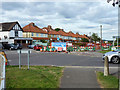
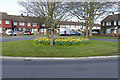
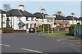
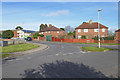
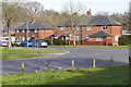
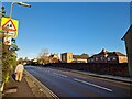
Photos of GU12 4EW


Area Information
Living in GU12 4EW means being part of a tightly knit residential cluster in England, where 1850 people reside across just 1.1 hectares. This high population density creates a compact, community-focused environment, ideal for those seeking proximity to amenities without the sprawl of larger towns. The area’s median age of 47 suggests a mature demographic, with adults aged 30-64 forming the largest group. This reflects a stable, established community, where 60% of homes are owner-occupied, and houses dominate the housing stock. The area’s small size means residents are likely to know their neighbours, with daily life centred around local shops, schools, and transport links. Nearby, The Connaught School provides primary education, while rail stations like Aldershot and Farnham offer easy access to wider networks. With broadband rated at 100 and mobile coverage at 83, connectivity is robust, supporting both remote work and leisure. GU12 4EW balances residential tranquillity with practical access to services, making it a viable choice for those prioritising convenience and community.
- Area Type
- Postcode
- Area Size
- 1.1 hectares
- Population
- 1850
- Population Density
- 4787 people/km²
GU12 4EW’s property market is characterised by a 60% home ownership rate, with houses forming the majority of the housing stock. This suggests a predominantly owner-occupied area, likely appealing to families and long-term residents seeking stability. The small size of the postcode—just 1.1 hectares—means the housing stock is limited, which could create competition for available properties. Given the high population density, homes here are likely to be smaller or part of a tightly packed residential cluster. For buyers, this area’s compact nature means proximity to amenities is a key advantage, though the limited size may restrict options for larger properties. The predominance of houses over flats or apartments may appeal to those prioritising space and privacy, though the market’s dynamics are shaped by the small, defined boundaries of the postcode.
House Prices in GU12 4EW
Showing 18 properties
| Address | Type | Beds | Baths | Last Sale Price | Last Sale Date | |
|---|---|---|---|---|---|---|
| 97 Lower Farnham Road, Aldershot, GU12 4EW | Terraced | 4 | 1 | £432,000 | Jul 2024 | |
| 103 Lower Farnham Road, Aldershot, GU12 4EW | Terraced | 3 | 2 | £375,000 | Dec 2022 | |
| 83 Lower Farnham Road, Aldershot, GU12 4EW | Semi-detached | 4 | 2 | £390,000 | Nov 2019 | |
| 79 Lower Farnham Road, Aldershot, GU12 4EW | Semi-detached | 3 | - | £327,000 | Dec 2017 | |
| 109 Lower Farnham Road, Aldershot, GU12 4EW | Terraced | 3 | 1 | £310,000 | Oct 2017 | |
| 81 Lower Farnham Road, Aldershot, GU12 4EW | Semi-detached | 4 | 2 | £305,000 | Mar 2017 | |
| 89 Lower Farnham Road, Aldershot, GU12 4EW | Bungalow | - | - | £123,000 | May 2001 | |
| 85 Lower Farnham Road, Aldershot, GU12 4EW | Detached | 3 | 1 | - | - | |
| 111 Lower Farnham Road, Aldershot, GU12 4EW | Semi-detached | - | - | - | - | |
| 101 Lower Farnham Road, Aldershot, GU12 4EW | Semi-detached | - | - | - | - |
Energy Efficiency in GU12 4EW
Residents of GU12 4EW have access to a range of amenities within easy reach. Retail options include The Southern Co-operative, Sainsburys Aldershot, and Asda Tongham, ensuring daily shopping needs are met. Rail stations like Aldershot and Farnham provide direct links to larger towns and cities, while Farnborough Airport offers regional travel convenience. The area’s compact nature means amenities are closely clustered, reducing the need for long commutes. This proximity to shops, transport, and travel hubs contributes to a lifestyle that balances local convenience with broader connectivity. The mix of retail and transport infrastructure supports both practical living and opportunities for leisure or business travel, enhancing the area’s appeal for a variety of lifestyles.
Amenities
Schools
The Connaught School is the primary educational institution within reach of GU12 4EW, providing essential schooling for younger residents. As a primary school, it serves children aged 4-11, making it a critical resource for families with young children. The absence of secondary schools in the immediate vicinity means parents may need to consider commuting to nearby towns for secondary education. The single primary school highlights the area’s focus on early education, though the lack of additional schools could impact choices for families requiring multiple educational options. The school’s presence, however, ensures that primary-level needs are met within the local area, contributing to the community’s family-friendly character.
| Rank | School | Type | Entry gender | Ages |
|---|
Explore more schools in this area
Go to Schools tabDemographics
GU12 4EW’s population of 1850 is concentrated in a small area, resulting in a high density of 168,958 people per square kilometre. The median age of 47 indicates a mature community, with adults aged 30-64 comprising the largest age group. This suggests a stable population with established households, likely including families and professionals. Home ownership stands at 60%, with houses being the predominant accommodation type. The area’s demographic profile reflects a low proportion of younger residents or renters, which may influence local services and amenities. The predominant ethnic group is White, though no specific diversity data is provided. The absence of deprivation metrics means quality of life indicators are not explicitly detailed, but the high home ownership rate and mature age profile suggest a relatively affluent and settled community.
Household Size
Accommodation Type
Tenure
Ethnic Group
Religion
Household Composition
Age
Household Deprivation
NS-SEC
Explore more demographic insights in this area
Go to Demographics tabPlanning
Planning Constraints
- Flood RiskPremium
- Ramsar Wetland SitesPremium
- Area of Outstanding Natural BeautyPremium
- Protected Nature ReservePremium
- Protected WoodlandPremium