Area Overview for GU12 4BL
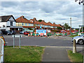
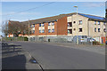
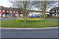
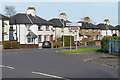
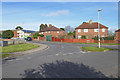
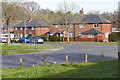
Photos of GU12 4BL


Area Information
GU12 4BL is a small residential postcode area in England, covering just 4,947 square metres and home to 1,850 residents. Its high population density — 373,967 people per square kilometre — reflects a compact, tightly knit community. This area is characterised by its mix of housing and proximity to key amenities, making it appealing for those seeking a balance between urban convenience and residential tranquillity. The presence of nearby schools, rail networks, and retail hubs ensures daily life is well-supported. While the area is small, it connects to broader regional infrastructure, including Farnborough Airport and multiple railway stations. The demographic profile suggests a mature population, with a median age of 47 and a significant proportion of adults aged 30–64. This suggests a stable, established community, likely centred around local employment and family-oriented living. For buyers, GU12 4BL offers a focused, manageable environment where amenities are within easy reach, though its size means it is best suited for those prioritising proximity to services over expansive space.
- Area Type
- Postcode
- Area Size
- 4947 m²
- Population
- 1850
- Population Density
- 4787 people/km²
GU12 4BL is a small area with a housing stock primarily composed of owner-occupied homes, with 60% of properties owned by residents. The prevalence of houses over flats or apartments suggests a traditional, family-focused market, likely attracting buyers seeking private, spacious living. Given the area’s compact size, the property market is limited in scale, which may mean fewer options for buyers but also less competition. The concentration of houses could indicate a preference for detached or semi-detached properties, possibly reflecting the area’s suburban or semi-rural character. For buyers, this means a focus on individual properties rather than rental portfolios, though the exact availability of homes for sale or rent is not specified. The proximity to amenities such as schools and rail links may enhance the appeal of properties here, particularly for those prioritising convenience over large plots of land.
House Prices in GU12 4BL
Showing 16 properties
| Address | Type | Beds | Baths | Last Sale Price | Last Sale Date | |
|---|---|---|---|---|---|---|
| 61 The Avenue, Aldershot, GU12 4BL | Semi-detached | 3 | 1 | £360,000 | Oct 2022 | |
| 57 The Avenue, Aldershot, GU12 4BL | Semi-detached | 3 | 1 | £280,000 | Mar 2019 | |
| 43 The Avenue, Aldershot, GU12 4BL | Semi-detached | 3 | 1 | £232,950 | Mar 2014 | |
| 45 The Avenue, Aldershot, GU12 4BL | Semi-detached | 3 | 1 | £210,000 | Jul 2012 | |
| 63 The Avenue, Aldershot, GU12 4BL | Semi-detached | - | - | £191,000 | Jan 2006 | |
| 49 The Avenue, Aldershot, GU12 4BL | Detached | 3 | 2 | £155,000 | Aug 2005 | |
| 51 The Avenue, Aldershot, GU12 4BL | Semi-detached | - | - | £150,000 | Mar 2003 | |
| 67 The Avenue, Aldershot, GU12 4BL | Semi-detached | - | - | £130,000 | Sep 2001 | |
| 65 The Avenue, Aldershot, GU12 4BL | Semi-detached | 3 | 1 | £110,000 | Jan 2001 | |
| 41 The Avenue, Aldershot, GU12 4BL | Semi-detached | 3 | - | - | - |
Energy Efficiency in GU12 4BL
Residents of GU12 4BL have access to a range of amenities within practical reach. Retail options include The Southern Co-operative Co, Sainsburys Aldershot, and Asda Tongham, providing everyday shopping needs. The area’s rail network, with stations such as Aldershot and Farnham, connects to broader transport systems, facilitating travel to nearby towns and cities. Farnborough Airport is also nearby, offering additional travel flexibility. While the data does not specify parks or leisure facilities, the presence of multiple retail and transport hubs suggests a convenient, service-oriented lifestyle. The compact nature of the area means amenities are closely clustered, reducing the need for long commutes. This makes GU12 4BL suitable for those who value accessibility and a well-connected environment, though buyers should verify the availability of green spaces or recreational areas beyond the listed amenities.
Amenities
Schools
The nearest school to GU12 4BL is The Connaught School, a primary institution. While no secondary schools are listed in the data, the presence of a primary school suggests the area is well-served for younger children. Families with primary-aged children may find this a key factor in their decision to live here. The absence of secondary schools nearby could mean that students would need to travel to adjacent areas for further education, which may be a consideration for parents planning long-term. The single school listed indicates a focused educational offering for younger children, though the data does not provide details on its Ofsted rating or academic performance. This means buyers should conduct further research into the school’s quality and how it aligns with their children’s needs.
| Rank | School | Type | Entry gender | Ages |
|---|
Explore more schools in this area
Go to Schools tabDemographics
The population of GU12 4BL is predominantly adults aged 30–64, with a median age of 47. This indicates a mature, settled community, likely with strong family ties and established careers. Home ownership stands at 60%, suggesting a mix of long-term residents and owner-occupied properties. The accommodation type is primarily houses, which aligns with the area’s residential character and may appeal to those seeking traditional housing. The predominant ethnic group is White, reflecting a homogenous demographic profile. While no specific data on deprivation or diversity is provided, the age range and home ownership figures suggest a stable, middle-aged population with a focus on private living. The absence of detailed diversity metrics means the community’s social composition remains largely unexplored in the data. However, the high proportion of adult residents implies a low presence of younger families or students, which may influence local services and amenities.
Household Size
Accommodation Type
Tenure
Ethnic Group
Religion
Household Composition
Age
Household Deprivation
NS-SEC
Explore more demographic insights in this area
Go to Demographics tabPlanning
Planning Constraints
- Flood RiskPremium
- Ramsar Wetland SitesPremium
- Area of Outstanding Natural BeautyPremium
- Protected Nature ReservePremium
- Protected WoodlandPremium