Area Overview for GU12 4AF
Photos of GU12 4AF
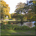

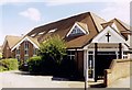
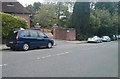
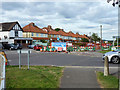
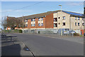
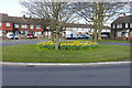
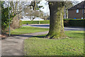
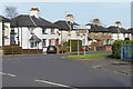
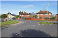
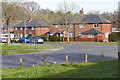
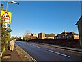
69 photos from this area
Area Information
Key information about the GU12 4AF including its size, population, and administrative classification.
- Area Type
- Postcode
- Area Size
- 1.4 hectares
- Population
- 1540
- Population Density
- 3185 people/km²
House Prices in GU12 4AF
31
Properties
£235,313
Average Sold Price
£159,500
Lowest Price
£365,000
Highest Price
Showing 31 properties
| Address | Type | Beds | Baths | Last Sale Price | Last Sale Date | |
|---|---|---|---|---|---|---|
| 68 Whyte Avenue, Aldershot, GU12 4AF | Semi-detached | 3 | 2 | £365,000 | Mar 2023 | |
| 81 Whyte Avenue, Aldershot, GU12 4AF | house | 2 | - | £345,000 | Jul 2022 | |
| 60 Whyte Avenue, Aldershot, GU12 4AF | house | - | - | £175,000 | Jan 2020 | |
| 77 Whyte Avenue, Aldershot, GU12 4AF | house | - | - | £275,000 | May 2016 | |
| 69 Whyte Avenue, Aldershot, GU12 4AF | Terraced | 3 | 2 | £159,500 | May 2011 | |
| 91 Whyte Avenue, Aldershot, GU12 4AF | house | - | - | £176,000 | Mar 2011 | |
| 46 Whyte Avenue, Aldershot, GU12 4AF | Semi-detached | 3 | 2 | £196,000 | Dec 2009 | |
| 97 Whyte Avenue, Aldershot, GU12 4AF | house | 3 | - | £191,000 | Jun 2007 | |
| Cafe In The Park, Parkside Cafe In The Park, Aldershot Park, Guildford Road, Aldershot, GU12 4AF | Restaurant | - | - | - | - | |
| 58 Whyte Avenue, Aldershot, GU12 4AF | house | - | - | - | - |
Page 1 of 4
Energy Efficiency in GU12 4AF
Amenities
Schools
| Rank | School | Type | Entry gender | Ages |
|---|
Explore more schools in this area
Go to Schools tabDemographics
Household Size
Family (3-5 people)
most common
Accommodation Type
Houses
most common
Tenure
36
majority
Ethnic Group
White
most common
Religion
N/A
most common
Household Composition
N/A
most common
Age
47
median
Adults (30-64 years)
most common
Household Deprivation
N/A
with no deprivation
NS-SEC
18
in Lower managerial occupations
Explore more demographic insights in this area
Go to Demographics tabPlanning
Planning Constraints
- Flood RiskPremium
- Ramsar Wetland SitesPremium
- Area of Outstanding Natural BeautyPremium
- Protected Nature ReservePremium
- Protected WoodlandPremium