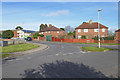
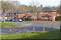
Area Overview for GU12 4AD
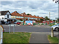
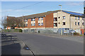
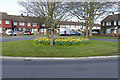
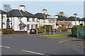
Photos of GU12 4AD


Area Information
GU12 4AD is a small, densely populated residential cluster in England, covering just 1.0 hectare and home to 1,850 residents. Its compact size means it is a tightly knit community, with a high population density of 181,739 people per square kilometre. This area is characterised by its mature demographic, with a median age of 47 and a strong presence of adults aged 30–64. Daily life here is shaped by its proximity to essential services, including five retail outlets such as Sainsburys Aldershot and Asda Tongham, and easy access to rail networks like Aldershot and Ash Vale stations. The area’s low crime risk score of 78 and absence of environmental constraints make it appealing for families and professionals seeking a balance between convenience and safety. While it lacks large-scale amenities, its compact design ensures residents can reach nearby towns and facilities swiftly, making it a practical choice for those prioritising accessibility over expansive living spaces.
- Area Type
- Postcode
- Area Size
- 1.0 hectares
- Population
- 1850
- Population Density
- 4787 people/km²
GU12 4AD is a predominantly owner-occupied area, with 60% of homes owned by residents rather than rented. The accommodation type is exclusively houses, which is unusual for a small postcode area but suggests a focus on family homes or single-family residences. Given the area’s compact size and high population density, the housing stock is limited, likely comprising a mix of older properties and newer builds. The high home ownership rate indicates a stable market, with fewer rental properties available. For buyers, this means competition for a small number of homes, but also potential for long-term investment in a low-risk environment. The absence of planning constraints or environmental restrictions further enhances its appeal, as development is not hindered by protected sites or flood risks. However, the small size of the area means buyers should consider nearby suburbs for additional options.
House Prices in GU12 4AD
Showing 28 properties
| Address | Type | Beds | Baths | Last Sale Price | Last Sale Date | |
|---|---|---|---|---|---|---|
| 12 Whyte Avenue, Aldershot, GU12 4AD | Terraced | 2 | 1 | £320,000 | Feb 2024 | |
| 25 Whyte Avenue, Aldershot, GU12 4AD | Terraced | 2 | 1 | £340,000 | Mar 2023 | |
| 7 Whyte Avenue, Aldershot, GU12 4AD | Terraced | 2 | 1 | £286,000 | Jan 2019 | |
| 23 Whyte Avenue, Aldershot, GU12 4AD | Terraced | 2 | - | £271,000 | Jan 2019 | |
| 27 Whyte Avenue, Aldershot, GU12 4AD | Terraced | 2 | - | £272,000 | Oct 2018 | |
| 22 Whyte Avenue, Aldershot, GU12 4AD | Terraced | 2 | 1 | £252,000 | May 2017 | |
| 8 Whyte Avenue, Aldershot, GU12 4AD | Terraced | 2 | 1 | £245,000 | Aug 2015 | |
| 2 Whyte Avenue, Aldershot, GU12 4AD | house | - | - | £238,000 | Sep 2014 | |
| 16 Whyte Avenue, Aldershot, GU12 4AD | house | - | - | £172,000 | Nov 2010 | |
| 24 Whyte Avenue, Aldershot, GU12 4AD | house | - | - | £165,000 | Aug 2009 |
Energy Efficiency in GU12 4AD
The lifestyle in GU12 4AD is shaped by its proximity to essential amenities. Five retail outlets, including Sainsburys Aldershot and The Southern Co-operative Co, provide everyday shopping needs, while nearby rail stations offer swift access to larger towns and cities. The presence of Farnborough Airport adds to the area’s connectivity, enabling travel to major destinations. While the data does not list parks or leisure facilities, the rail links and retail options suggest a practical, service-oriented lifestyle. Residents can enjoy a mix of convenience and accessibility, with minimal need to travel far for essentials. The compact nature of the area means daily life is efficient, though those seeking expansive green spaces may need to explore further afield.
Amenities
Schools
The primary school nearest to GU12 4AD is The Connaught School. No secondary schools are listed in the data, so families may need to look beyond the immediate area for comprehensive education. The presence of a primary school suggests the area is suitable for young children, though parents should investigate nearby secondary options for continuity. The single school type indicates a focus on early education, which may be adequate for families with younger children but less so for those requiring a full range of schooling. The lack of additional schools in the data means it is worth verifying the proximity of secondary institutions when considering the area for long-term family needs.
| Rank | School | Type | Entry gender | Ages |
|---|
Explore more schools in this area
Go to Schools tabDemographics
The community in GU12 4AD is predominantly composed of adults aged 30–64, with a median age of 47. This suggests a mature, stable population, likely with established careers and families. Home ownership is high at 60%, indicating a strong presence of long-term residents. The area is primarily composed of houses, reflecting a traditional residential layout. The predominant ethnic group is White, which aligns with broader regional trends. With no specific data on deprivation or diversity beyond this, the area appears to cater to a homogenous, middle-aged demographic. The high home ownership rate and age profile suggest a community focused on stability, with limited turnover. This may influence local services and amenities, which are tailored to the needs of families and professionals rather than younger or more transient populations.
Household Size
Accommodation Type
Tenure
Ethnic Group
Religion
Household Composition
Age
Household Deprivation
NS-SEC
Explore more demographic insights in this area
Go to Demographics tabPlanning
Planning Constraints
- Flood RiskPremium
- Ramsar Wetland SitesPremium
- Area of Outstanding Natural BeautyPremium
- Protected Nature ReservePremium
- Protected WoodlandPremium