Area Overview for GU11 4BT
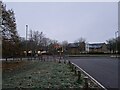
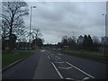
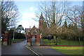
Photos of GU11 4BT


Area Information
Living in GU11 4BT offers a compact, tightly knit residential experience in a small cluster of homes. With a population of 1,699 spread over just 1.0 hectare, the area is densely populated yet maintains a quiet, residential character. The median age of 22 contrasts with the most common age group of 30–64 years, suggesting a mix of younger residents and established families. This small postcode is well-served by nearby amenities, including five retail outlets like Morrisons Aldershot and Lidl Central, and five rail stations, such as Aldershot and Ash Vale, offering easy access to regional transport. Digital connectivity is excellent, with a broadband score of 100 and mobile coverage rated 83, supporting remote work and daily internet use. The area’s low crime risk (74/100) and no flood or environmental constraints make it a practical choice for those prioritising safety and convenience. While its size limits expansion, GU11 4BT’s proximity to major transport hubs and retail centres ensures a lifestyle balanced between urban accessibility and residential tranquillity.
- Area Type
- Postcode
- Area Size
- 1.0 hectares
- Population
- 1699
- Population Density
- 5912 people/km²
The property market in GU11 4BT is defined by its small size and high population density. With 51% of residents owning their homes, the area leans towards owner-occupation, though the remaining 49% likely reflects a rental market. The accommodation type is predominantly houses, which is unusual for a densely packed postcode but may indicate a mix of semi-detached or terraced properties. Given the area’s compact nature, properties are likely to be closely spaced, with limited scope for expansion. Buyers should consider the proximity to major transport routes and amenities, as the area’s value may be tied to its accessibility. The absence of environmental constraints and low crime risk further enhances its appeal for those seeking a secure, practical home. However, the limited size of GU11 4BT means the housing stock is finite, and competition for properties may be keen, particularly for those prioritising location over space.
House Prices in GU11 4BT
Showing 31 properties
| Address | Type | Beds | Baths | Last Sale Price | Last Sale Date | |
|---|---|---|---|---|---|---|
| 22 Pennefathers Road, Wellesley, Aldershot, GU11 4BT | Maisonette | 2 | 2 | £280,000 | Jan 2025 | |
| 28 Pennefathers Road, Wellesley, Aldershot, GU11 4BT | Detached | 4 | 2 | £560,000 | Jan 2023 | |
| 62 Pennefathers Road, Wellesley, Aldershot, GU11 4BT | house | - | - | £554,995 | Aug 2022 | |
| 24 Pennefathers Road, Wellesley, Aldershot, GU11 4BT | house | - | - | £545,000 | Jun 2022 | |
| 10 Pennefathers Road, Wellesley, Aldershot, GU11 4BT | Retail | 5 | 4 | £540,000 | Apr 2020 | |
| 34 Pennefathers Road, Wellesley, Aldershot, GU11 4BT | house | - | - | £445,000 | Feb 2020 | |
| 52 Pennefathers Road, Wellesley, Aldershot, GU11 4BT | house | - | - | £410,000 | Dec 2019 | |
| 38 Pennefathers Road, Wellesley, Aldershot, GU11 4BT | house | - | - | £445,000 | Dec 2019 | |
| 54 Pennefathers Road, Wellesley, Aldershot, GU11 4BT | house | - | - | £410,000 | Dec 2019 | |
| 56 Pennefathers Road, Wellesley, Aldershot, GU11 4BT | house | - | - | £410,000 | Nov 2019 |
Energy Efficiency in GU11 4BT
Residents of GU11 4BT benefit from a range of nearby amenities within practical reach. The area is served by five retail outlets, including Morrisons Aldershot and Tesco Aldershot, ensuring easy access to groceries and everyday shopping. Rail stations like Aldershot and Ash Vale provide connections to broader transport networks, while nearby airports—Farnborough and Blackbushe—enhance regional mobility. Though the area itself is small, its proximity to larger towns means residents can access additional leisure, dining, and cultural options beyond the immediate postcode. The compact layout ensures that essential services are close, reducing the need for long commutes. However, the limited local footprint means the character of the area is defined by its practicality rather than expansive green spaces or sprawling facilities. For those valuing convenience and accessibility, GU11 4BT offers a lifestyle centred on efficiency and connectivity.
Amenities
Schools
| Rank | School | Type | Entry gender | Ages |
|---|
Explore more schools in this area
Go to Schools tabDemographics
GU11 4BT has a population density of 167,904 people per square kilometre, reflecting its small, tightly packed footprint. The median age of 22 is notably lower than the most common age range of 30–64 years, indicating a community with a mix of younger residents and older households. Home ownership stands at 51%, with the remaining 49% likely to be renters, suggesting a blend of long-term residents and transient occupants. The predominant ethnic group is White, with no specific data on other demographics. The high population density, combined with a 1.0 hectare area, means living spaces are closely spaced, which may influence the character of daily life. While deprivation data is not provided, the low crime risk and proximity to essential services suggest a functional, if compact, quality of life. The area’s demographic profile hints at a stable, working-age population with access to local employment and transport links.
Household Size
Accommodation Type
Tenure
Ethnic Group
Religion
Household Composition
Age
Household Deprivation
NS-SEC
Explore more demographic insights in this area
Go to Demographics tabPlanning
Planning Constraints
- Flood RiskPremium
- Ramsar Wetland SitesPremium
- Area of Outstanding Natural BeautyPremium
- Protected Nature ReservePremium
- Protected WoodlandPremium