Area Overview for GU11 3YS
Photos of GU11 3YS


Area Information
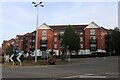
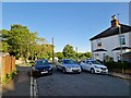
Living in GU11 3YS offers a quiet, residential experience within a small cluster of homes. With a population of 1,428, the area feels intimate, catering to those seeking a settled lifestyle. The community is predominantly middle-aged, with a median age of 47, and most residents are homeowners, reflecting a stable, long-term presence. Situated near Aldershot and Farnham, the area benefits from proximity to regional amenities without the bustle of larger towns. Daily life is shaped by nearby retail outlets, rail links, and digital connectivity. Broadband scores 100, ensuring seamless online access, while mobile coverage scores 83, supporting both remote work and everyday use. The low flood risk and absence of environmental constraints make it a practical choice for families or professionals seeking reliability. Though small, the area’s mix of housing and transport options offers a balanced lifestyle for those prioritising convenience and safety.
- Area Type
- Postcode
- Area Size
- Not available
- Population
- 1428
- Population Density
- 10547 people/km²
The property market in GU11 3YS is characterised by a 61% home ownership rate, with houses forming the majority of accommodation types. This suggests a market skewed towards owner-occupied properties rather than rentals, likely attracting buyers seeking long-term stability. The small area’s housing stock is limited, which may mean fewer choices for buyers but could also indicate a competitive market for available homes. The predominance of houses over flats or apartments aligns with the area’s appeal to families or professionals prioritising space and privacy. For those considering the area, the compact nature of GU11 3YS means buyers should look beyond immediate surroundings for additional options. The focus on owner-occupation implies a community with strong ties to local properties, potentially offering a sense of permanence.
House Prices in GU11 3YS
No properties found in this postcode.
Energy Efficiency in GU11 3YS
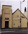
GU11 3YS residents have access to five retail outlets, including Morrisons Daily, Tesco Aldershot, and Morrisons Aldershot, ensuring convenience for shopping and daily essentials. The area’s rail stations connect to nearby towns, while nearby airports offer regional travel options. Though the data does not mention parks or leisure facilities, the presence of multiple retail and transport hubs suggests a practical lifestyle focused on accessibility. The compact nature of the area means amenities are within practical reach, though variety may be limited compared to larger towns. This makes GU11 3YS suitable for those prioritising convenience over extensive leisure options, with a focus on essential services and connectivity.
Amenities
Schools
The nearest school to GU11 3YS is West End Infant School, a primary school serving young children. No secondary schools or further education institutions are listed in the data, meaning families may need to look beyond the immediate area for comprehensive schooling. The presence of a primary school is a practical asset for parents with young children, reducing commuting distances. However, the lack of nearby secondary schools could be a consideration for those planning for older children’s education. The single listed school suggests a limited educational infrastructure, requiring families to factor in travel time or availability of transport to broader regional schools.
| Rank | School | Type | Entry gender | Ages |
|---|---|---|---|---|
| 1 | West End Infant School | primary | N/A | N/A |
Explore more schools in this area
Go to Schools tabDemographics
GU11 3YS is home to 1,428 residents, with a median age of 47, indicating a mature, established community. The most common age range is 30–64, suggesting a strong presence of working-age adults and families. Home ownership stands at 61%, with houses being the primary accommodation type, reflecting a preference for traditional, stable housing. The predominant ethnic group is White, and no specific data on deprivation or diversity is provided. This demographic profile implies a community focused on long-term residency, with limited turnover. The age range and ownership figures suggest a population that values security and continuity, with fewer transient residents. The absence of detailed diversity metrics means the area’s social composition remains largely unexplored in the data, but the figures highlight a settled, middle-aged demographic.
Household Size
Accommodation Type
Tenure
Ethnic Group
Religion
Household Composition
Age
Household Deprivation
NS-SEC
Explore more demographic insights in this area
Go to Demographics tabPlanning
Planning Constraints
- Flood RiskPremium
- Ramsar Wetland SitesPremium
- Area of Outstanding Natural BeautyPremium
- Protected Nature ReservePremium
- Protected WoodlandPremium
- Crime RiskPremium