Area Overview for GU11 1ZP
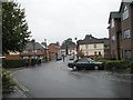
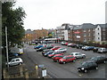
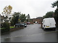
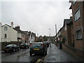
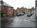
Photos of GU11 1ZP


Area Information
GU11 1ZP is a small residential postcode in England, home to 2,273 people. This area is characterised by its compact layout, with a focus on flats as the primary form of accommodation. The community here is predominantly composed of adults aged 30–64, reflecting a mature demographic. Daily life is shaped by proximity to key amenities, including retail stores, rail networks, and a nearby airport. The area’s size means it is tightly knit, with residents likely to know their neighbours. While it lacks large-scale infrastructure, its accessibility to Aldershot and surrounding towns provides a balance between local convenience and regional connectivity. The postcode’s small footprint means it is a focused community, where the rhythm of life is influenced by nearby services and transport links. For those seeking a quiet, established residential area with practical access to essentials, GU11 1ZP offers a straightforward, no-frills living environment.
- Area Type
- Postcode
- Area Size
- Not available
- Population
- 2273
- Population Density
- 9542 people/km²
GU11 1ZP is a small area where 41% of homes are owner-occupied, with flats making up the majority of the housing stock. This indicates a rental market that is more prominent than outright ownership, likely due to the area’s compact size and the prevalence of purpose-built flats. For buyers, this dynamic suggests limited opportunities for purchasing property, as the market is dominated by landlords and tenants rather than private homeowners. The concentration of flats may also mean that properties are more uniform in size and layout, offering fewer variations for buyers to choose from. Given the area’s small footprint, prospective buyers should consider nearby regions for a broader range of housing options. The low home ownership rate also implies that the area may not be a priority for investors seeking long-term capital growth.
House Prices in GU11 1ZP
No properties found in this postcode.
Energy Efficiency in GU11 1ZP
The lifestyle in GU11 1ZP is shaped by its proximity to retail and transport hubs. Nearby shops include Iceland Aldershot, Lidl Central, and Morrisons Aldershot, offering a range of grocery and household essentials. The rail network provides access to Aldershot, Ash, and North Camp stations, facilitating travel to work, leisure, or shopping. Farnborough Airport adds another layer of connectivity for those requiring regional travel. While the area lacks detailed information on parks or leisure facilities, its retail and transport links suggest a practical, service-oriented lifestyle. Residents can access daily necessities without long commutes, though the absence of specific leisure venues means the area’s recreational options remain undefined in the data.
Amenities
Schools
The nearest school to GU11 1ZP is Rowhill School, which is categorised as an 'other' type in the data. No specific Ofsted rating or performance metrics are provided, so its educational quality remains unquantified. The absence of additional schools in the data means families relying on local education may need to look beyond the immediate area for options. The single listed school suggests that parents might need to consider commuting to nearby towns for a broader range of educational institutions. Without further details on school performance or availability, prospective residents should conduct their own research into local educational provisions.
| Rank | School | Type | Entry gender | Ages |
|---|
Explore more schools in this area
Go to Schools tabDemographics
The population of GU11 1ZP has a median age of 47, with the majority of residents falling within the 30–64 age range. This suggests a community of working-age adults, many of whom may be settled in long-term housing. Home ownership rates are relatively low at 41%, indicating that a significant portion of the housing stock is rented. The area is dominated by flats, which aligns with the demographic profile of a mature, possibly retired or established workforce. The predominant ethnic group is White, though no specific data on diversity or deprivation levels is provided. The absence of detailed diversity metrics means the community’s composition remains largely unexplored in the data. The age profile and housing type suggest a stable, low-turnover environment, where residents may prioritise convenience over property investment.
Household Size
Accommodation Type
Tenure
Ethnic Group
Religion
Household Composition
Age
Household Deprivation
NS-SEC
Explore more demographic insights in this area
Go to Demographics tabPlanning
Planning Constraints
- Flood RiskPremium
- Ramsar Wetland SitesPremium
- Area of Outstanding Natural BeautyPremium
- Protected Nature ReservePremium
- Protected WoodlandPremium