Area Overview for GU10 5XX
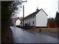
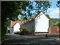
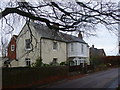
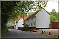
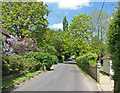
Photos of GU10 5XX


Area Information
GU10 5XX is a small residential postcode area in England, covering 21.3 hectares with a population of 1658 people. Its low population density of 87 people per square kilometre suggests a quiet, community-focused environment. The area is characterised by a mix of housing stock, with 80% of residents owning their homes. This suggests a stable, long-term community, likely centred around family-oriented living. The median age of 47 indicates a predominantly middle-aged population, with the majority of residents falling within the 30–64 age range. This demographic profile hints at a mature, settled neighbourhood where local amenities and services are likely tailored to adult needs. The area’s compact size means residents are close to essential services, while its lack of significant environmental constraints—no protected woodlands, wetlands, or AONB designations—offers flexibility for development. For those seeking a peaceful, low-maintenance lifestyle, GU10 5XX combines residential comfort with practical accessibility to nearby towns and transport links.
- Area Type
- Postcode
- Area Size
- 21.3 hectares
- Population
- 1658
- Population Density
- 87 people/km²
The property market in GU10 5XX is dominated by owner-occupied homes, with 80% of properties owned by residents rather than rented. This high ownership rate suggests a stable, long-term community with limited turnover. The accommodation type is primarily houses, which is typical for smaller, residential postcode areas with low population density. This implies a market focused on family homes and single-family living, rather than apartments or shared housing. Given the area’s compact size, the housing stock is likely limited, which could mean competitive conditions for buyers. However, the lack of planning constraints—such as protected woodlands or AONB designations—may offer flexibility for future development. For buyers, this area could appeal to those seeking a quiet, established neighbourhood with a strong sense of community, though the limited size may restrict options for larger properties or investment opportunities.
House Prices in GU10 5XX
Showing 2 properties
| Address | Type | Beds | Baths | Last Sale Price | Last Sale Date | |
|---|---|---|---|---|---|---|
| Living Accommodation, B U P A, Clare Park, Farnham, GU10 5XX | Flat | - | - | - | - | |
| Spire Clare Park Hospital, Crondall Lane, Crondall, Farnham, GU10 5XX | hospital_care_home | - | - | - | - |
Energy Efficiency in GU10 5XX
GU10 5XX offers access to a range of local amenities within practical reach. Retail options include Waitrose Little Waitrose, Co-op Church, and Tesco Farnham, providing a mix of supermarket and grocery services. The presence of multiple rail stations ensures easy access to nearby towns, enhancing connectivity for shopping, dining, and leisure. While the area itself is small, its proximity to larger centres means residents can enjoy a broader selection of services. The retail and transport infrastructure suggests a lifestyle that balances local convenience with the ability to venture further for more specialised needs. The compact nature of the area may foster a close-knit community, where daily life is centred around familiar, accessible amenities.
Amenities
Schools
The nearest school to GU10 5XX is St Nicholas’ School, an independent institution. Independent schools are typically fee-paying and may offer specialised curricula or smaller class sizes. While the data does not include Ofsted ratings, the presence of a single school suggests that families in the area may have limited options for state education. However, the independent sector can provide alternative pathways for those prioritising private education. The absence of other schools in the immediate vicinity means parents may need to consider commuting to nearby towns for additional educational choices. For families valuing the structure and resources of independent schooling, St Nicholas’ School could be a key factor in deciding to live in GU10 5XX.
| Rank | School | Type | Entry gender | Ages |
|---|
Explore more schools in this area
Go to Schools tabDemographics
The community in GU10 5XX is predominantly composed of adults aged 30–64, with a median age of 47. This suggests a mature, established population, likely with strong ties to the area. Home ownership is high at 80%, indicating a stable housing market where most residents are long-term residents rather than renters. The accommodation type is primarily houses, which aligns with the area’s low density and suburban character. The predominant ethnic group is White, with no specific data on other demographics provided. This homogeneity may influence the social fabric of the area, though it is not uncommon in smaller, rural postcode clusters. The absence of detailed diversity statistics means the community’s cultural composition remains less defined. The age profile and ownership rates suggest a place where families and professionals may find a balance between privacy and proximity to services.
Household Size
Accommodation Type
Tenure
Ethnic Group
Religion
Household Composition
Age
Household Deprivation
NS-SEC
Explore more demographic insights in this area
Go to Demographics tabPlanning
Planning Constraints
- Flood RiskPremium
- Ramsar Wetland SitesPremium
- Area of Outstanding Natural BeautyPremium
- Protected Nature ReservePremium
- Protected WoodlandPremium