Area Overview for GU10 5RL
Photos of GU10 5RL

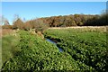
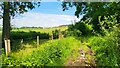
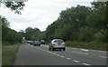
14 photos from this area
Area Information
Key information about the GU10 5RL including its size, population, and administrative classification.
- Area Type
- Postcode
- Area Size
- 15.2 hectares
- Population
- 1658
- Population Density
- 87 people/km²
House Prices in GU10 5RL
9
Properties
£1,026,286
Average Sold Price
£315,000
Lowest Price
£3,111,000
Highest Price
Showing 9 properties
| Address | Type | Beds | Baths | Last Sale Price | Last Sale Date | |
|---|---|---|---|---|---|---|
| Downsland House, Bowling Alley, Crondall, Farnham, GU10 5RL | house | 3 | - | £3,111,000 | May 2025 | |
| East View, Bowling Alley, Crondall, Farnham, GU10 5RL | house | - | - | £990,000 | Oct 2020 | |
| Hillside, Bowling Alley, Crondall, Farnham, GU10 5RL | Detached | 9 | 4 | £800,000 | May 2015 | |
| Oak Royal Cottage, Bowling Alley, Crondall, Farnham, GU10 5RL | Bungalow | 2 | 1 | £430,000 | Sep 2014 | |
| Royal Oak House, Bowling Alley, Crondall, Farnham, GU10 5RL | Bungalow | 5 | - | £1,200,000 | Aug 2012 | |
| Bowling Hill Cottage, Bowling Alley, Crondall, Farnham, GU10 5RL | Detached | 4 | 2 | £315,000 | Jan 1999 | |
| Meadow View, Bowling Alley, Crondall, Farnham, GU10 5RL | house | - | - | £338,000 | Jan 1999 | |
| Tall Oaks, Bowling Alley, Crondall, Farnham, GU10 5RL | Detached | - | - | - | - | |
| Erlands Cottage, Bowling Alley, Crondall, Farnham, GU10 5RL | house | - | - | - | - |
Energy Efficiency in GU10 5RL
Amenities
Schools
| Rank | School | Type | Entry gender | Ages |
|---|
Explore more schools in this area
Go to Schools tabDemographics
Household Size
Two person
most common
Accommodation Type
Houses
most common
Tenure
80
majority
Ethnic Group
White
most common
Religion
N/A
most common
Household Composition
N/A
most common
Age
47
median
Adults (30-64 years)
most common
Household Deprivation
N/A
with no deprivation
NS-SEC
48
in Lower managerial occupations
Explore more demographic insights in this area
Go to Demographics tabPlanning
Planning Constraints
- Flood RiskPremium
- Ramsar Wetland SitesPremium
- Area of Outstanding Natural BeautyPremium
- Protected Nature ReservePremium
- Protected WoodlandPremium