Area Overview for GU10 5QU
Photos of GU10 5QU
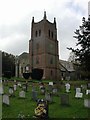

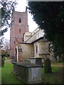
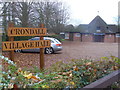
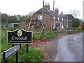
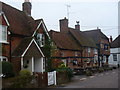
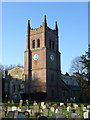
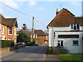
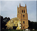

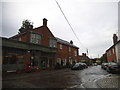
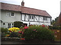
88 photos from this area
Area Information
Key information about the GU10 5QU including its size, population, and administrative classification.
- Area Type
- Postcode
- Area Size
- 8.4 hectares
- Population
- 1220
- Population Density
- 611 people/km²
House Prices in GU10 5QU
24
Properties
£641,471
Average Sold Price
£155,000
Lowest Price
£1,600,000
Highest Price
Showing 24 properties
| Address | Type | Beds | Baths | Last Sale Price | Last Sale Date | |
|---|---|---|---|---|---|---|
| Old Rose House, Pankridge Street, Crondall, Farnham, GU10 5QU | Detached | 4 | 1 | £1,100,000 | Feb 2024 | |
| Garretts Farm, Pankridge Street, Crondall, Farnham, GU10 5QU | Detached | - | - | £850,000 | May 2022 | |
| Hawthorn Lodge, Pankridge Street, Crondall, Farnham, GU10 5QU | Detached | 3 | 1 | £430,000 | Nov 2019 | |
| Gate House, Pankridge Street, Crondall, Farnham, GU10 5QU | house | - | - | £1,600,000 | Sep 2018 | |
| Bennells, Pankridge Street, Crondall, Farnham, GU10 5QU | Detached | 2 | 1 | £345,000 | Jan 2017 | |
| The White Cottage, Pankridge Street, Crondall, Farnham, GU10 5QU | house | - | - | £1,200,000 | Oct 2016 | |
| Tann House, Pankridge Street, Crondall, Farnham, GU10 5QU | Detached | - | - | £710,000 | Sep 2016 | |
| Kenlea, Pankridge Street, Crondall, Farnham, GU10 5QU | Detached | 3 | - | £530,000 | Nov 2013 | |
| Four Acres, Pankridge Street, Crondall, Farnham, GU10 5QU | house | 4 | - | £745,000 | Mar 2011 | |
| Willow Mead, Pankridge Street, Crondall, Farnham, GU10 5QU | house | - | - | £620,000 | Sep 2010 |
Page 1 of 3
Energy Efficiency in GU10 5QU
Amenities
Schools
| Rank | School | Type | Entry gender | Ages |
|---|
Explore more schools in this area
Go to Schools tabDemographics
Household Size
Two person
most common
Accommodation Type
Houses
most common
Tenure
72
majority
Ethnic Group
White
most common
Religion
N/A
most common
Household Composition
N/A
most common
Age
47
median
Adults (30-64 years)
most common
Household Deprivation
N/A
with no deprivation
NS-SEC
49
in Lower managerial occupations
Explore more demographic insights in this area
Go to Demographics tabPlanning
Planning Constraints
- Flood RiskPremium
- Ramsar Wetland SitesPremium
- Area of Outstanding Natural BeautyPremium
- Protected Nature ReservePremium
- Protected WoodlandPremium