Area Overview for GU10 4LH
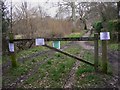
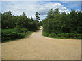
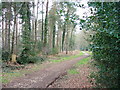
Photos of GU10 4LH


Area Information
GU10 4LH is a small residential postcode in England, home to 1,839 people spread across a low-density area with 124 residents per square kilometre. This compact cluster of homes reflects a quiet, community-focused environment, where the majority of residents are adults aged 30–64, with a median age of 47. The area is characterised by a mix of private housing, with 70% of properties owned by residents rather than rented. Daily life here is shaped by proximity to local amenities, including retail outlets and rail links, while the surrounding landscape remains largely unencumbered by environmental restrictions. The postcode’s small size means it is closely tied to nearby towns like Farnham and Alton, offering a balance between rural tranquillity and accessible urban connectivity. For those seeking a settled, low-maintenance lifestyle, GU10 4LH provides a stable backdrop, with a focus on family-oriented living and practical convenience. The presence of a primary school with a good Ofsted rating further reinforces its appeal to households prioritising education.
- Area Type
- Postcode
- Area Size
- Not available
- Population
- 1839
- Population Density
- 124 people/km²
The property market in GU10 4LH is dominated by owner-occupied homes, with 70% of properties in private hands. This contrasts with areas where rental markets dominate, suggesting a community of long-term residents rather than speculative investment. The accommodation type is primarily houses, which aligns with the area’s low density and suburban character. This housing stock is likely to appeal to families seeking space and privacy, though the small size of the postcode means the available properties are limited in number. Buyers should consider the proximity to nearby towns like Farnham and Alton, where additional options may exist. The emphasis on owner-occupation indicates a stable market with lower turnover, which can be advantageous for those seeking a reliable, low-risk purchase. However, the limited scale of the area means that property choices are constrained, requiring buyers to look beyond the immediate postcode for broader options.
House Prices in GU10 4LH
Showing 1 properties
| Address | Type | Beds | Baths | Last Sale Price | Last Sale Date | |
|---|---|---|---|---|---|---|
| Alice Holt Lodge, Gravel Hill Road, Holt Pound, Farnham, GU10 4LH | office_workshop | - | - | - | - |
Energy Efficiency in GU10 4LH
Daily life in GU10 4LH is supported by a modest but practical array of amenities. The area includes five retail outlets, such as Spar, The Southern Co-operative Co, and Morrisons Daily, offering essentials for everyday needs. Rail connectivity is strong, with four nearby stations providing access to Farnham, Alton, and other towns, facilitating commuting or weekend travel. The presence of RAF Odiham nearby adds a unique element, though its civilian accessibility is limited. While the area lacks dedicated parks or leisure facilities, the proximity to rail networks and local shops suggests a lifestyle focused on convenience and connectivity. The small scale of the postcode means that residents may need to venture slightly further for specialist services, but the immediate vicinity provides sufficient support for basic living requirements.
Amenities
Schools
The nearest school to GU10 4LH is Bentley Church of England Primary School, which serves the local community with a primary education offering. This school holds an Ofsted rating of ‘good’, reflecting its effectiveness in teaching and student outcomes. The absence of secondary schools within the postcode means families may need to look to nearby towns like Farnham or Alton for further education. The presence of a single primary school suggests a focus on early years education, though the limited range of school types may require additional commuting for older children. For parents prioritising quality education, the ‘good’ rating at Bentley Church of England Primary School is a positive indicator, but the lack of diversity in school options could be a consideration for those needing access to a broader range of educational institutions.
| Rank | School | Type | Entry gender | Ages |
|---|
Explore more schools in this area
Go to Schools tabDemographics
The population of GU10 4LH is predominantly adults, with 30–64-year-olds making up the most common age range. The median age of 47 suggests a mature, established community, likely with a high proportion of long-term residents. Home ownership is strong, with 70% of properties occupied by their owners, indicating a stable housing market. The area is largely composed of houses rather than flats, reflecting a preference for single-family dwellings. The predominant ethnic group is White, though specific data on diversity or deprivation is not provided. The low population density of 124 people per square kilometre implies a spread-out, possibly suburban or semi-rural layout. For those considering this area, the demographic profile suggests a community focused on continuity, with fewer transient residents and a reliance on local services. The absence of detailed diversity metrics means broader social dynamics remain unquantified, but the data points to a cohesive, family-oriented population.
Household Size
Accommodation Type
Tenure
Ethnic Group
Religion
Household Composition
Age
Household Deprivation
NS-SEC
Explore more demographic insights in this area
Go to Demographics tabPlanning
Planning Constraints
- Flood RiskPremium
- Ramsar Wetland SitesPremium
- Area of Outstanding Natural BeautyPremium
- Protected Nature ReservePremium
- Protected WoodlandPremium